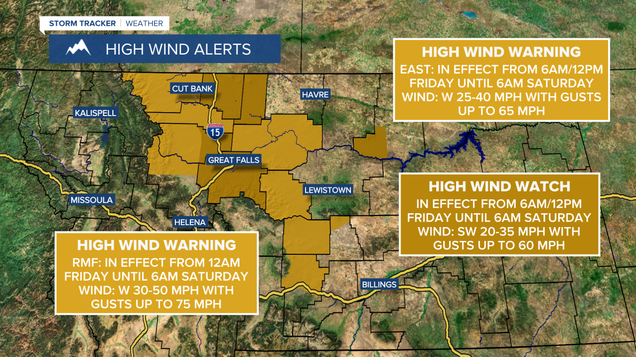
A High Wind Warning is in effect for the Rocky Mountain Front from 12am Friday until 6am Saturday. Sustained wind speeds are going to be between 30 and 50 mph, and wind gusts up to 75 mph are going to be possible at times.
A High Wind Warning is also in effect for eastern Pondera County, Chouteau County, and Judith Basin County from 6am or 12pm Friday until 6am Saturday. Sustained wind speeds are going to be between 25 and 40 mph, and wind gusts up to 65 mph are going to be possible at times.
There is also a High Wind Watch in effect for Cascade County, Liberty County, eastern Teton County and Toole County from 6am or 12pm Friday until 6am Saturday. Sustained wind speeds are going to be between 20 and 35 mph, and wind gusts up to 60 mph are going to be possible at times.
A Wind Chill Advisory is in effect for northeastern Montana, including northern Valley County, until 2pm Friday. Wind chills as low as 30 below zero are possible.

We are going to have partly cloudy to mostly clear skies and mainly dry conditions tonight. It is also going to be chilly tonight as lows are going to be in the single digits and teens in most locations. We are also going to have increasing wind tonight along the Rocky Mountain Front and in locations around and west of I-15.
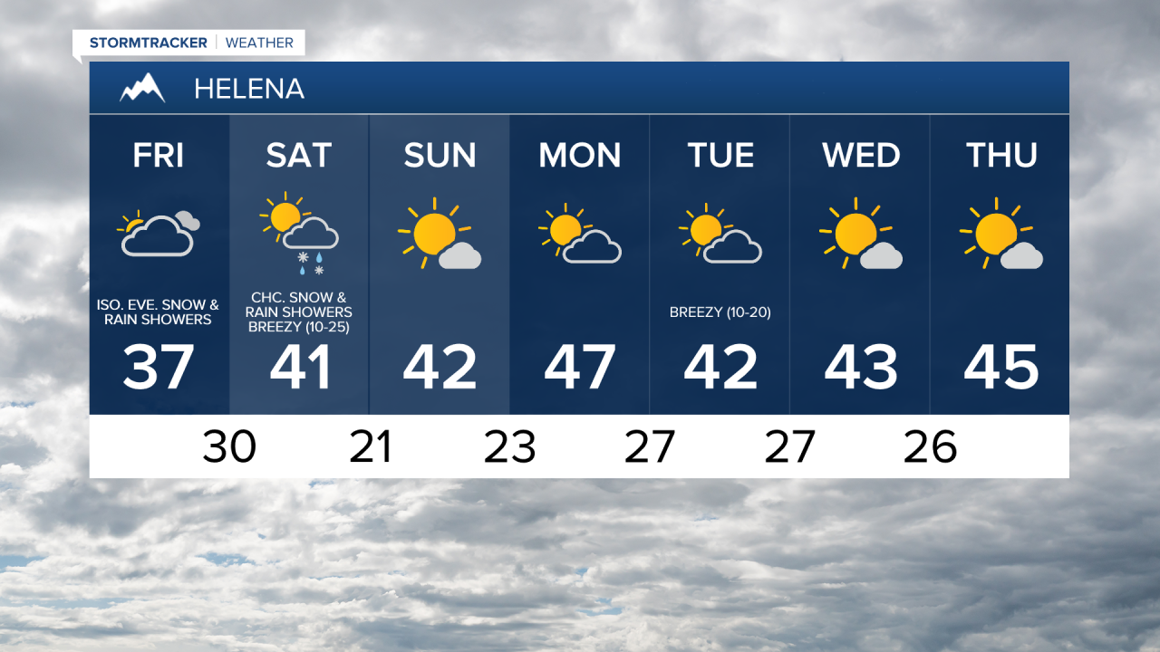
For tomorrow, we are going to have increasing clouds with some isolated snow and rain showers, generally during the evening and generally in the mountains, as a disturbance begins to approach our area. We are also going to have widespread gusty to strong winds around tomorrow, especially during the afternoon and evening, as sustained wind speeds are going to be between 20 and 40 mph, and wind gusts over 60 mph are going to be possible at times. It is also going to be warmer tomorrow than it was today as highs are going to be in the mid to upper 30s and low to mid 40s.
There are then going to be some scattered snow and rain showers around tomorrow night and Saturday, especially in the mountains, as a disturbance passes through our area. We are also going to continue to have widespread strong winds around Friday night as sustained wind speeds are going to be between 20 and 40 mph, and wind gusts over 60 mph are going to be possible at times. We are then going to have widespread gusty to strong winds around on Saturday as sustained wind speeds are going to be between 10 and 30 mph, and wind gusts over 40 mph are going to be possible at times. It is also going to be mild on Saturday as highs are going to be in the upper 30s and low to mid 40s.
For Sunday and most of next week, we are going to have partly cloudy to mostly sunny skies and mostly dry conditions as high pressure is going to be in control of our weather. It is also going to be mild Sunday and most of next week as highs are going to be in the 40s and low to mid 50s. We are also going to have gusty to strong winds around Sunday and most of next week as sustained wind speeds are going to be between 10 and 30 mph, and wind gusts over 40 mph are going to be possible at times.