

An upper-level ridge is going to be in control of our weather for the entire work week and the upcoming holiday weekend. This means that we are going to have lots of sunshine, mainly dry conditions, and well above average temperatures for at least the next seven days.

In terms of cloud cover, we are going to have mostly to mainly sunny skies through at least next Monday, with the “cloudiest” days being Thursday and Saturday.
In terms of precipitation, most, if not all locations are going to be dry over the next week. However, a few isolated showers and thunderstorms are possible Wednesday night into Thursday morning and this weekend as a couple weak disturbances pass through our area.
The wind is not going to be a huge issue over the next week, but it is going to be breezy on Thursday, Saturday, and Sunday, especially during the PM hours, as sustained wind speeds are going to be between 10 and 25 mph, and wind gusts up to 40 mph are going to be possible at times. This wind coupled with hot temperatures and low relative humidity is going to create elevated fire danger, so please do your part to not start any new fires.
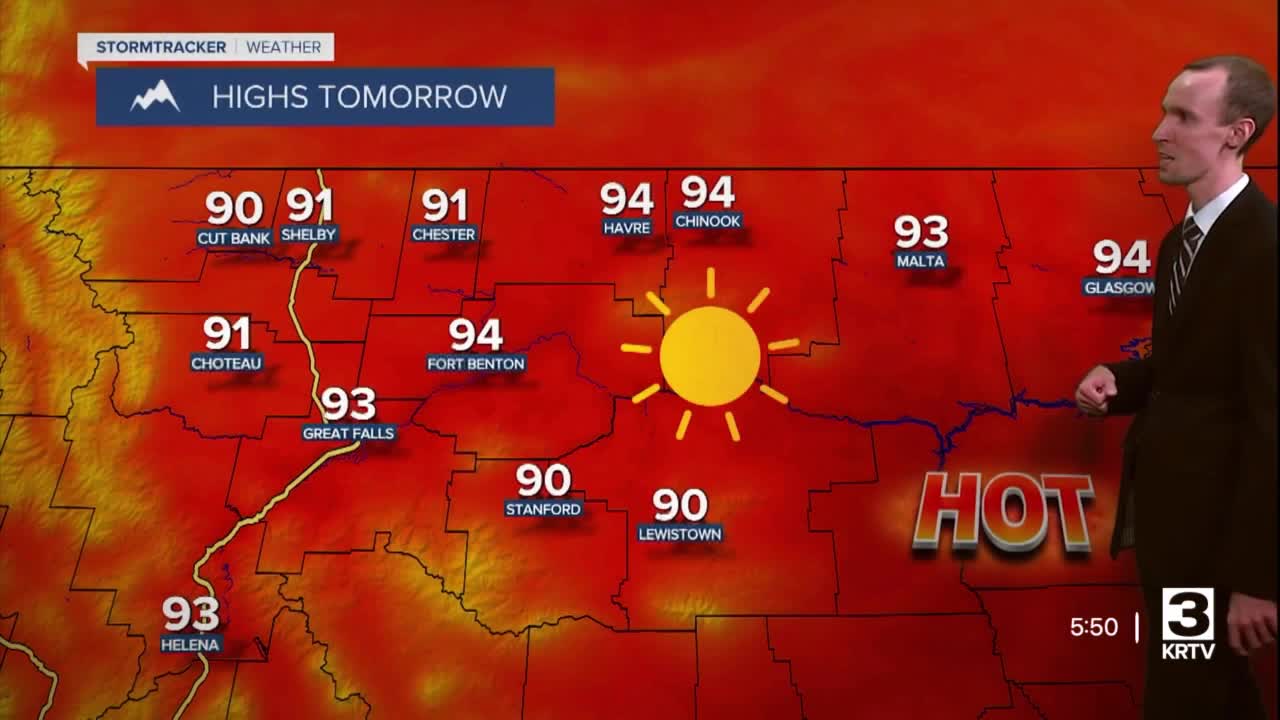
Now we get to the temperatures, which are by far going to be the biggest story of the next week. High temperatures from tomorrow through Saturday are going to be in the 90s, and a few locations may top out in the low 100s, especially on Wednesday and Saturday, which are currently forecasted to be the hottest days. We are also likely going to set some new record high temperatures this week, with Saturday likely being the day that the most new record high temperatures are set.
Since it is going to be hot this week, make sure you try and avoid being outside during the hottest part of the day; make sure you stay hydrated; make sure you seek shade or spend time in the air conditioning as much as possible; and make sure you check on those who are more susceptible to heat illnesses, including your pets.
We will get some relief from the heat at night, but even our nighttime temperatures are going to be above average for this time of year with lows generally in the 50s and low 60s.
As we head into Sunday and Monday, it is still going to be hot, but it will be slightly cooler with highs back in the upper 80s and low to mid 90s. 80s are then expected for highs after Labor Day.


