


The big story this week is the heat. A Heat Advisory is in effect for central Montana from noon tomorrow through 9pm on Friday as high temperatures are going to be in the mid to upper 90s and lower 100s for the rest of the work week. Even though eastern Montana is not under any heat headlines, it is still going to be very hot in the eastern part of the state as high temperatures are also going to be in the mid to upper 90s and lower 100s for the rest of the work week. Thankfully, even though it is going to be hot during the day, at least we are going to get some relief from the heat at night as lows are going to range from the mid 50s to the mid 60s for the rest of the work week. Also, as of right now, Thursday is anticipated to be the hottest day in central Montana, while Friday is anticipated to be the hottest day in eastern Montana.

For this weekend and early next week, it is still going to be hot, but it will be a touch cooler than it is going to be for the rest of the work week as highs are going to be in the low to mid 90s in most locations. Lows this weekend are also going to remain in the low to mid 60s in most locations.
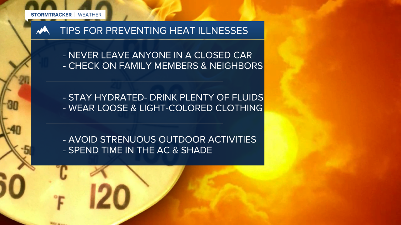
Now since it is going to be hot this week, make sure you limit your time outdoors during the heat of the day, and if you do have to be outside at all, make sure you stay hydrated; wear loose-fitting and light-colored clothing; take frequent breaks in the shade or AC; and avoid doing strenuous activities. Also, make sure you frequently check in on family members and neighbors this week to make sure that they are doing okay, and make sure you NEVER leave any pets or humans in a closed car as temperatures inside a car can get very hot very quickly. Additionally, it is important that you know the difference between heat exhaustion and heat stroke and what to do if you are experiencing any heat-related symptoms.

For tomorrow and Wednesday, you can expect sunny skies during the day and clear skies at night as high pressure is going to be in control of our weather. Mostly to mainly sunny skies and mainly dry conditions are then expected on Thursday as this area of high pressure starts to shift to our east. On Friday, Saturday, Sunday, and Monday, we are going to have a chance to see a few showers and thunderstorms, generally during the PM hours, as southwesterly flow aloft allows some moisture to work its way into our area. Right now, the mountains have the best chance to see some precipitation over these four days, although even then, the chance is not that high. Partly cloudy to mostly sunny skies are also expected over these four days.
The wind is going to be light tonight through tomorrow night. On Wednesday, it is going to be a little breezy as sustained wind speeds are going to be between 5 and 20 mph. Breezy conditions are then expected on Thursday, especially along the Hi-Line and in eastern Montana, as sustained wind speeds are going to be between 10 and 25 mph. With it being sunny, hot, dry, and breezy on Thursday, critical fire weather conditions are also expected. In eastern Montana, it will continue to be breezy on Friday as sustained wind speeds are going to be between 10 and 20 mph. There is then going to be a little bit of a breeze around this weekend as sustained wind speeds are going to be between 10 and 15 mph.


