


An unsettled weather pattern is expected this weekend and next week as we are going to have daily chances of showers and thunderstorms due to unstable southwesterly flow aloft since Montana will be in between an upper-level trough (to our northwest) and an upper-level ridge (to our southeast).

There are going to be some scattered showers and thunderstorms around the Helena area and in Judith Basin County and Fergus County this evening and early tonight as a disturbance impacts our area. Elsewhere, it will be mainly dry this evening and tonight. We are also going to have mostly clear skies and mild temperatures tonight as lows are going to be in the 50s in most locations.
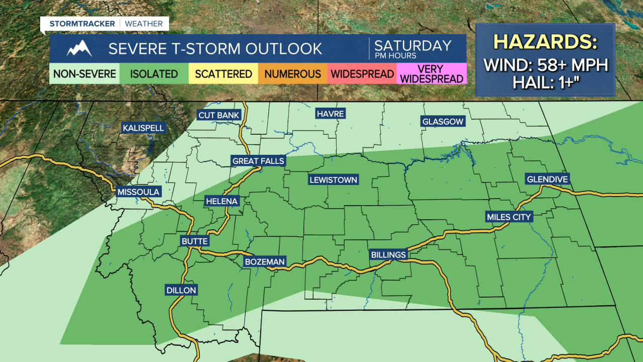
For this weekend, we are going to have partly to mostly sunny skies (via increasing clouds) with some scattered showers and thunderstorms around each afternoon and evening. These showers and thunderstorms will initially develop in southwestern Montana during the early afternoon and then trek north/northeastward as we go through the rest of the day, impacting the Helena area during the late afternoon and evening and impacting north-central Montana during the evening and early nighttime hours.
A couple of the thunderstorms that develop this weekend may be severe with damaging winds (58+ mph) and/or large hail (1+” in diameter). Although a lot of this weekend will be dry, make sure you are weather aware if you are going to be outdoors at all during the PM hours.
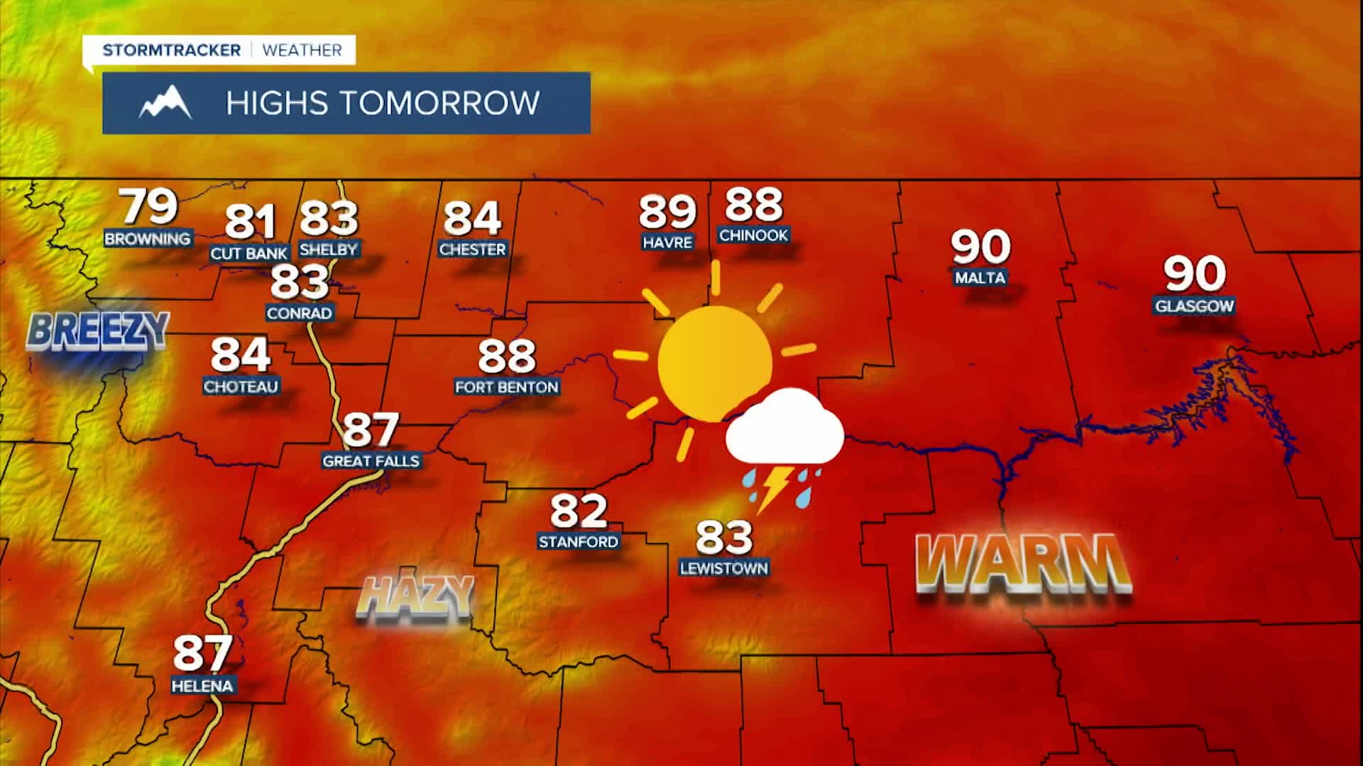
It is also going to be warm this weekend as highs are going to be in the 80s and low 90s tomorrow and the 80s and mid to upper 70s on Sunday. There will also be a bit of a breeze (10-20 mph) around tomorrow along the Rocky Mountain Front, with just a little breeze (5-20 mph) out across the plains.
There is also going to be some haze around this weekend in central Montana, especially around Helena, as some wildfire smoke from fires burning in central Idaho and southwestern Montana impacts our area. This smoke may cause the air quality to occasionally be unhealthy for sensitive groups.
There are then going to be scattered showers and thunderstorms around on Monday, Tuesday, and Wednesday, as multiple disturbances impact our area. On Tuesday and Wednesday, most of these showers and thunderstorms will occur during the afternoon and evening. We are also going to have partly cloudy skies and pleasant temperatures on these three days as highs are going to be in the mid to upper 70s and low to mid 80s in most locations. There is also going to be a breeze around in some areas on Tuesday and Wednesday as sustained wind speeds are going to be between 10 and 20 mph, and this wind will be coming out of the east-northeast.
On Thursday and Friday, we are going to have partly cloudy skies with some scattered showers and thunderstorms around as we remain in an unsettled weather pattern. It is also going to continue to be warm on these two days as highs are going to be in the 80s and upper 70s in most spots.


