A High Wind Warning is in effect for Glacier County, northwestern Lewis and Clark County, Pondera County, western Teton County, and Toole County until 5pm Wednesday. Sustained wind speeds are going to be between 30 and 50 mph, and wind gusts up to 75+ mph are going to be possible at times.

Widespread windy conditions are expected in north-central Montana through Wednesday evening. In the plains, sustained wind speeds are going to be between 15 and 35 mph, and wind gusts over 50 mph are going to be possible at times. Along and just east of the Rocky Mountain Front, sustained wind speeds are going to be between 30 and 50 mph, and wind gusts over 75 mph are going to be possible at times. On Thursday, it is still going to be breezy, but the wind will gradually diminish as the day goes on. Also, these strong winds are going to cause there to be areas of blowing and drifting snow around, especially along the Rocky Mountain Front, so please be careful when driving.
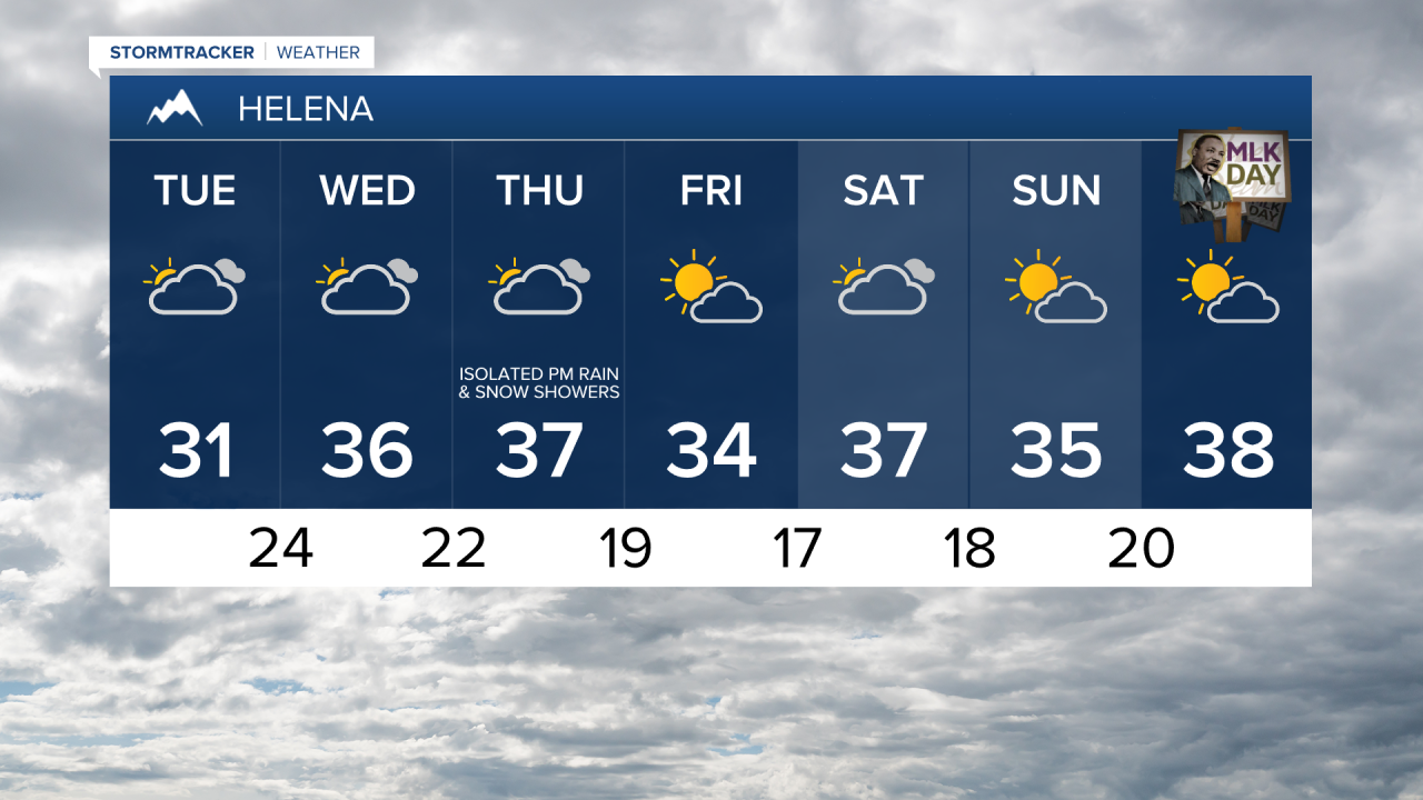
To go along with the gusty to strong winds, we are also going to have mild temperatures over the next several days. For tomorrow through Thursday, highs are going to be in the 30s and 40s, and a few spots may even top out in the low 50s. At night, it is going to be mild as well as lows from tonight through Wednesday night are going to be in the 20s and 30s, with some teens around in the valleys. Over the next few days, the warmest temperatures are going to be where the chinook wind is the strongest (along the Rocky Mountain Front and in the plains), while the coldest temperatures are going to be where we have the least wind (in the valleys, including Helena).
For tonight, tomorrow, and tomorrow night, we are going to have partly to mostly cloudy skies with a few snow and rain showers around, generally in the mountains. On Wednesday, we are going to have mostly cloudy skies with a few valley rain and mountain rain/snow showers around, especially during the afternoon and evening. We are then going to have partly to mostly cloudy skies with a couple isolated rain and snow showers around during the daylight hours on Thursday.
There are then going to be some scattered rain and snow showers around Thursday evening and Thursday night as a weak disturbance passes through our area. We are then going to have partly cloudy skies with a slight chance of AM snow showers on Friday. The temperatures are also going to cool down some between Thursday and Friday as highs on Friday are going to be in the 30s in most locations. We are also going to have less wind around on Friday as sustained wind speeds are going to be between 5 and 15 mph in most locations.
For this weekend, we are going to have mostly cloudy skies with a slight chance of rain and snow showers on Saturday, and partly cloudy to mostly sunny skies and dry conditions on Sunday. We are then going to have partly to mostly cloudy skies and dry conditions on Monday. It is also going to be breezy on these three days in north-central Montana as sustained wind speeds are going to be between 10 and 20 mph. We are also going to have above average temperatures on these three days as highs are going to be in the mid to upper 30s and low to mid 40s in most locations.