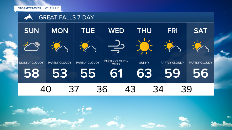


WEATHER DISCUSSION: High pressure takes control of the region, with windy and mainly dry conditions to the forecast as temperatures trend mild. This evening along the Rocky Mountain Front, expect some isolated snow showers. Otherwise, expect mostly cloudy skies with low temperatures in the 20s and 30s with 5 to 10 mph winds, gusts up to 20 mph.

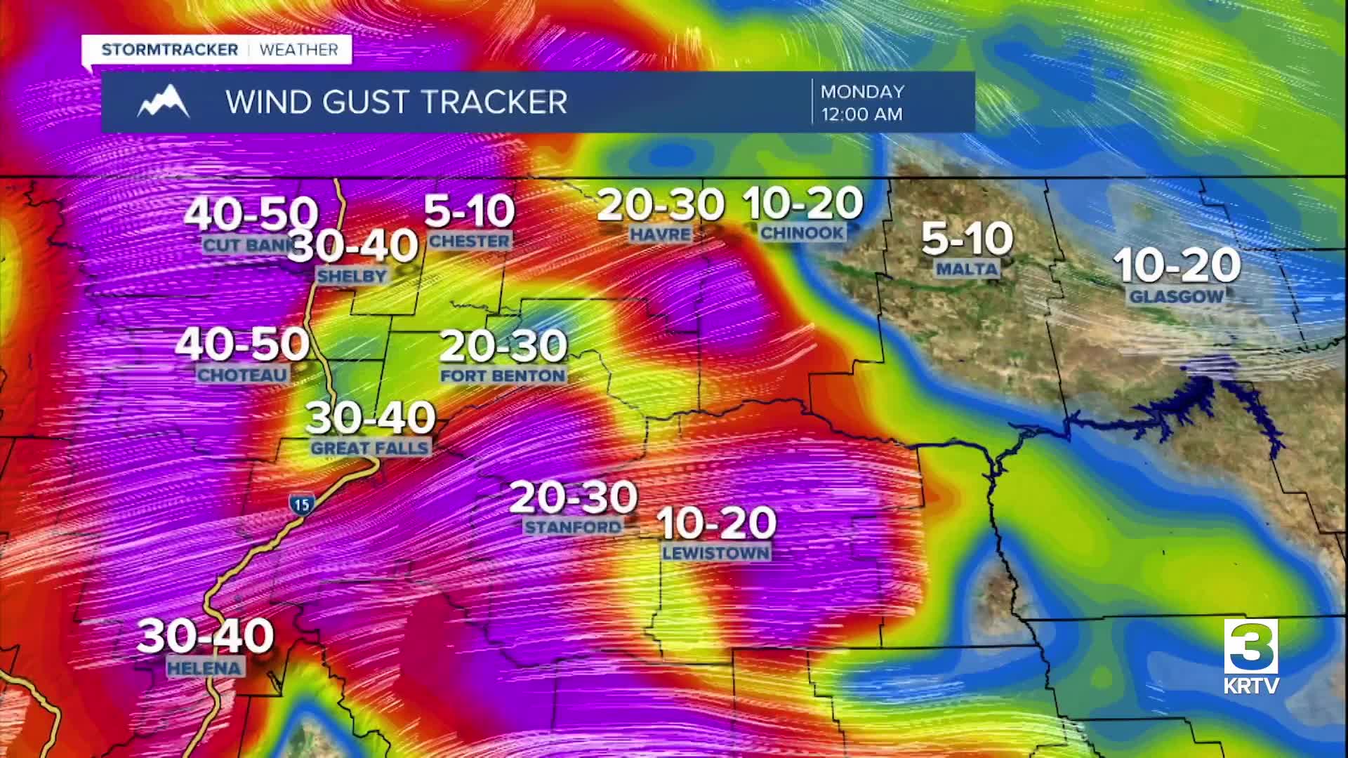
On Sunday, the upper-level ridge remains. This will keep warm and dry conditions for the area before it begins to flatten late Sunday afternoon/early Sunday evening as an upper-level shortwave trough moves over the area. This combined with a moderately strong surface pressure gradient will lead to windy conditions across North Central Montana with the strongest winds along the Rocky Mountain Front.
Windy conditions will linger into Monday morning. Because of the short-wave trough, expect isolated snow showers to the mountains of North Central Montana through Monday morning. An upper-level ridge will likely begin building back in Monday afternoon. Monday will be the coolest day of this forecast period (still well-above seasonal averages) with high temperatures in the 30s, 40s, and 50s. Expect partly cloudy skies and increasing winds.

Tuesday through Friday, the upper-level ridge will remain over the region, allowing temperatures to warm up each day through Thursday with mostly dry weather. Wednesday and Thursday will be the warmest days of this forecast period with high temperatures approaching or exceeding record highs for many locations. Periodic windy conditions are expected through next week with a slight cool down starting on Friday.