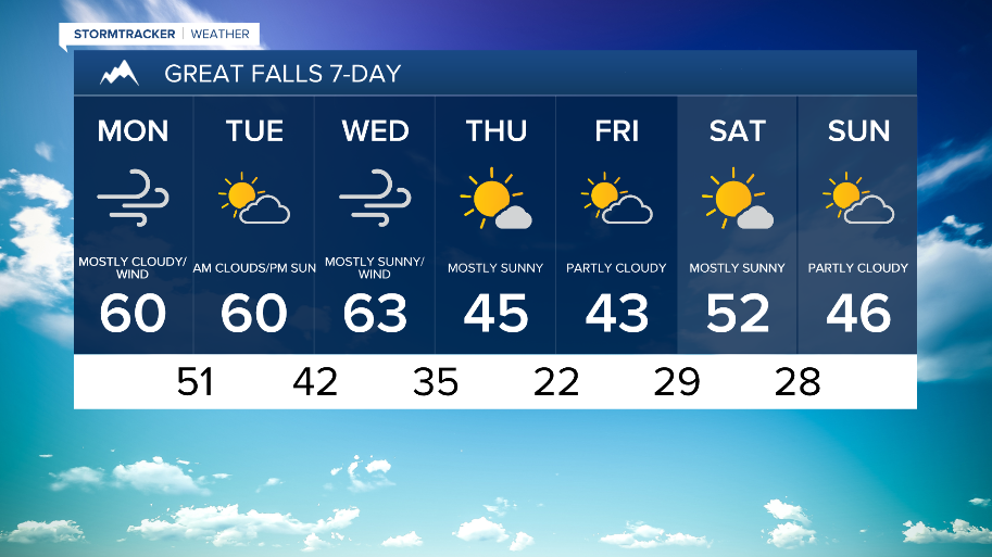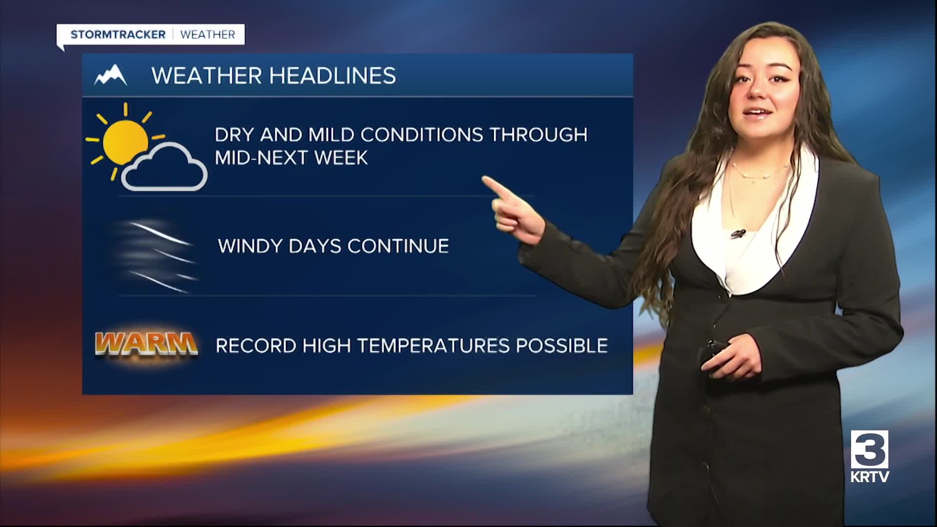


WEATHER DISCUSSION: Sunday saw another day of unseasonably mild and warmer temperatures with gusty winds increasing through the evening. High temperatures were seen in the 30s, 40s, and 50s with North Central, Central, and Southeastern Montana the warmest areas of the day.

Clouds increase as we head overnight tonight, with low temperatures expected in the 20s, 30s, and 40s. Expect gusty and windy conditions to increase tonight through tomorrow.
A large-scale upper-level ridge currently taking control of the region will amplify through the middle of the week in response to multiple shortwaves tracking over the ridge through Canada. These shortwaves will help continue strong wind gusts starting this evening along the Rocky Mountain Front.

Strong wind gusts look to expand further east across North Central MT on Monday, prompting High Wind Warnings through 9 pm Monday. Gusts could reach up to 85 mph.

Otherwise, expect more above average temperatures Monday, peeking in the upper-40s to upper-50s with mostly cloudy skies.

Tuesday and Wednesday, winds decrease some as the ridge amplifies to our west Unseasonably mild temperatures continue through Wednesday with daytime maximum temperature records likely to be challenged Tuesday and Wednesday as temps/heights peak. Persistent winds and cloud-cover will also keep overnight temperatures mild, particularly across the North Central MT plains.
A more northerly flow will bring some cooling to Thursday through next weekend, though most daily temperatures still look to remain slightly above seasonal averages for mid-January. Some light precipitation will be possible during this period as well.