We're tracking a cold front moving through North central Montana Tuesday afternoon.
The front will be dropping our temperatures, but is also bringing in low level moisture.
With that moisture in place, areas of freezing drizzle will be possible early Tuesday evening, which could lead to very slippery roads.
We'll be watching the radar closely for any signs of drizzle.
As the night progresses, upper level moisture will begin to move in, and temperatures will drop.
Than means any wintry mix will transition to all snow.
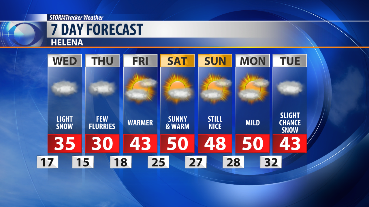
The snow will last on and off through the Wednesday, and even into Thursday.
Fortunately, the snow isn't looking heavy, with the hardest hit spots picking up an inch or two.
We;re also tracking cooler temperatures behind the front on Wednesday.
Highs will be mainly in the 20s, but a bit warmer to the south for places like Helena.