A Winter Weather Advisory is in effect for all of north-central Montana until 5am Friday. A light glaze of ice accumulation and up to 3 inches of new snow accumulation is possible. There are also going to be areas of freezing fog around, and some of this fog will be dense.

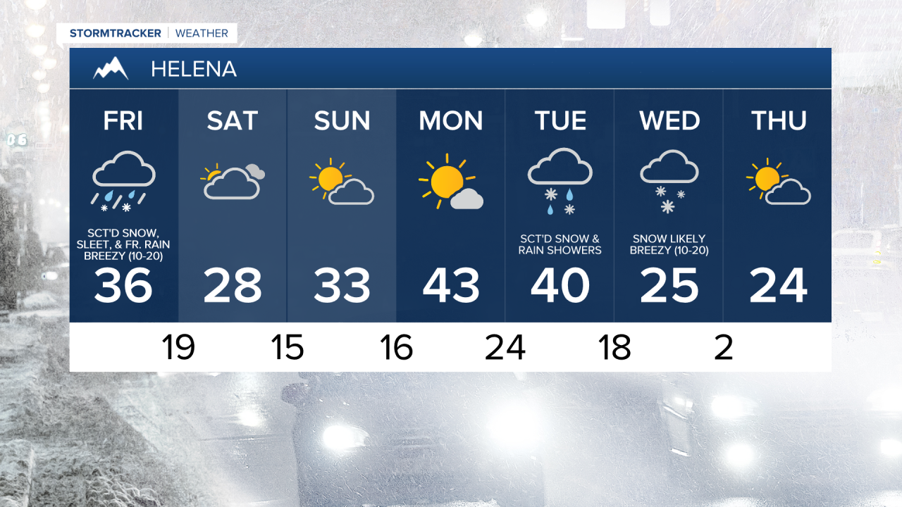
A cold front is going to bring another round of precipitation to our area tonight. This precipitation may initially begin as a wintry mix of rain, freezing rain, sleet, and snow, but will transition over to all snow as colder air aloft works its way into our area. There are then going to be scattered snow showers around tomorrow, especially during the morning, as this cold front continues to work its way southeastward through our area.
Between this evening and tomorrow evening, a light glaze of ice and up to 3 inches of new snow accumulation is possible. Slippery road conditions are also expected due to this snow and ice, so please be careful when driving and give yourself some extra time to get to where you need to go.

There are also going to be areas of fog around tonight and tomorrow, and some of this fog may be dense. Outside of this fog, you can expect mostly cloudy skies tonight and mostly to partly cloudy skies tomorrow, with more sunshine around in northern Montana and more clouds around in central and southern Montana.
It is also going to be chilly tonight and tomorrow as lows tonight are going to range from the mid teens to the low 30s, and highs tomorrow are going to be in the mid to upper 20s and low to mid 30s. There is also going to be a little bit of a breeze around tomorrow as sustained wind speeds are going to be between 5 and 20 mph.
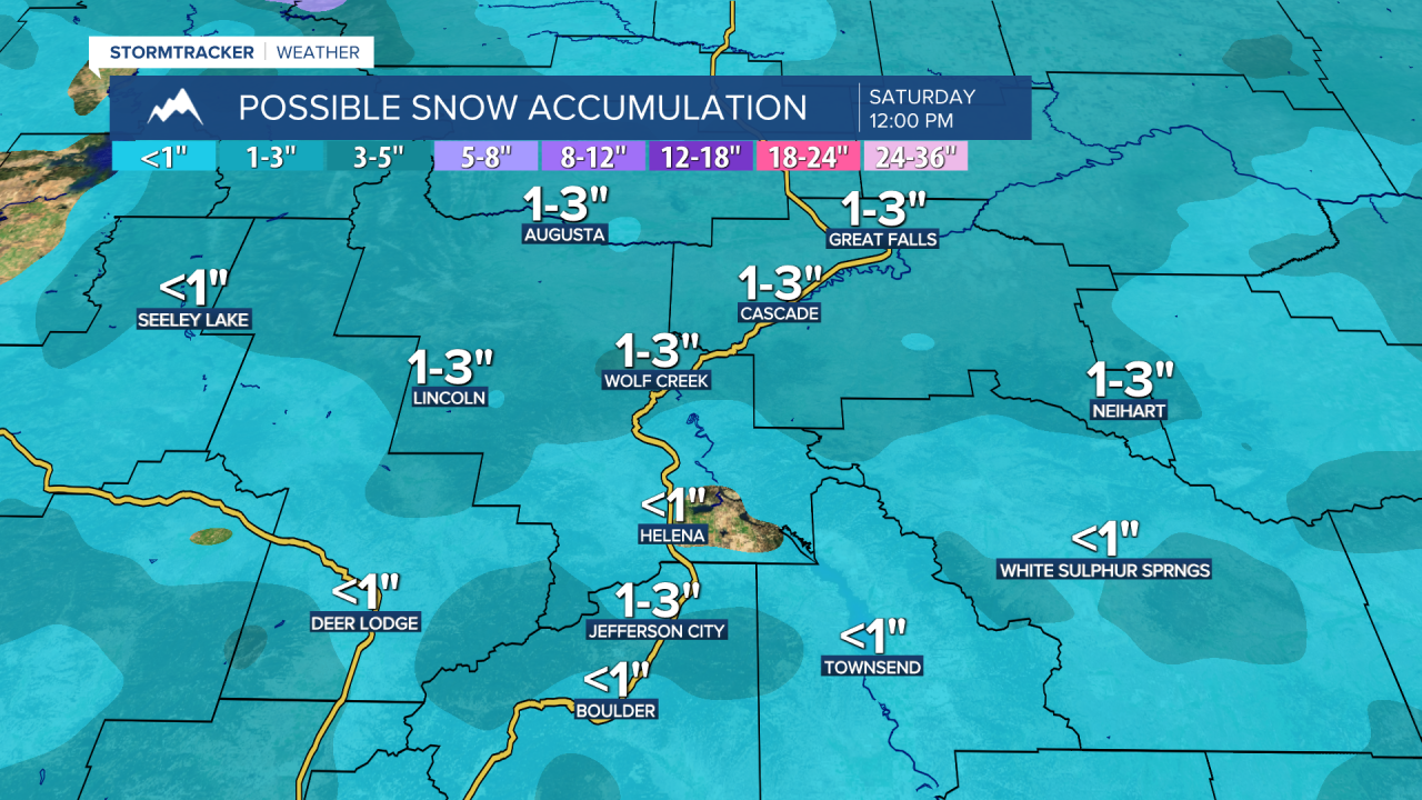
There are then going to be some scattered snow showers around tomorrow night, generally before midnight and generally in south-central Montana, as this cold front leaves our area. We are then going to have decreasing clouds with a slight chance of snow showers on Saturday. It is also going to be chilly on Saturday as highs are only going to be in the 20s.
On Sunday, we are going to have partly cloudy skies with a couple isolated snow showers around as a weak disturbance passes through our area. We are then going to have partly cloudy to mostly sunny skies and mainly dry conditions on Monday. The temperatures are also going to warm up some over these two days as highs on Sunday are going to be in the upper 20s and low to mid 30s, and highs on Monday are going to be in the upper 30s and low to mid 40s. It is also going to be breezy on Monday as sustained wind speeds are going to be between 10 and 20 mph.
There are then going to be scattered snow showers around on Tuesday and Wednesday, especially from Tuesday afternoon through Wednesday morning, as a storm system passes through our area. This storm system is also going to bring some much colder air to our area as highs on Wednesday and Thursday are only going to be in the upper teens and low to mid 20s, and lows Wednesday night may get below zero in spots. On Tuesday, we are going to have seasonable temperatures again as highs are going to be in the mid to upper 30s and low 40s. It is also going to be breezy on Tuesday and Wednesday as sustained wind speeds are going to be between 10 and 20 mph.