


Discussion:
A feed of moisture from the Pacific, known as an atmospheric river, is providing yet another damp weekend throughout Montana. While the heaviest rain will be focused well to the west of central Montana, clouds and scattered showers and thunderstorms are still expected for the rest of the weekend into early next week.
A closed low pressure system moves into northwestern Montana early next week. Unseasonably cold air wraps around it causing snow levels to drop to around 5000 feet by Monday evening. Upwards of a foot of snow is possible above 7000 feet with dangerous backcountry conditions expected.
Rain showers begin to diminish Tuesday night as the low pulls away. A ridge builds in right behind it resulting in drier conditions and warming temperatures for the second half of the week. Summer-like air is expected by week's end with some locations making a run for 90 degrees. The pattern of wet weekends looks to continue next weekend with chances for showers and thunderstorms yet again!
Saturday night: A few showers during the evening followed by mostly clear to partly cloudy skies overnight. Temperatures will fall into the upper 40s.

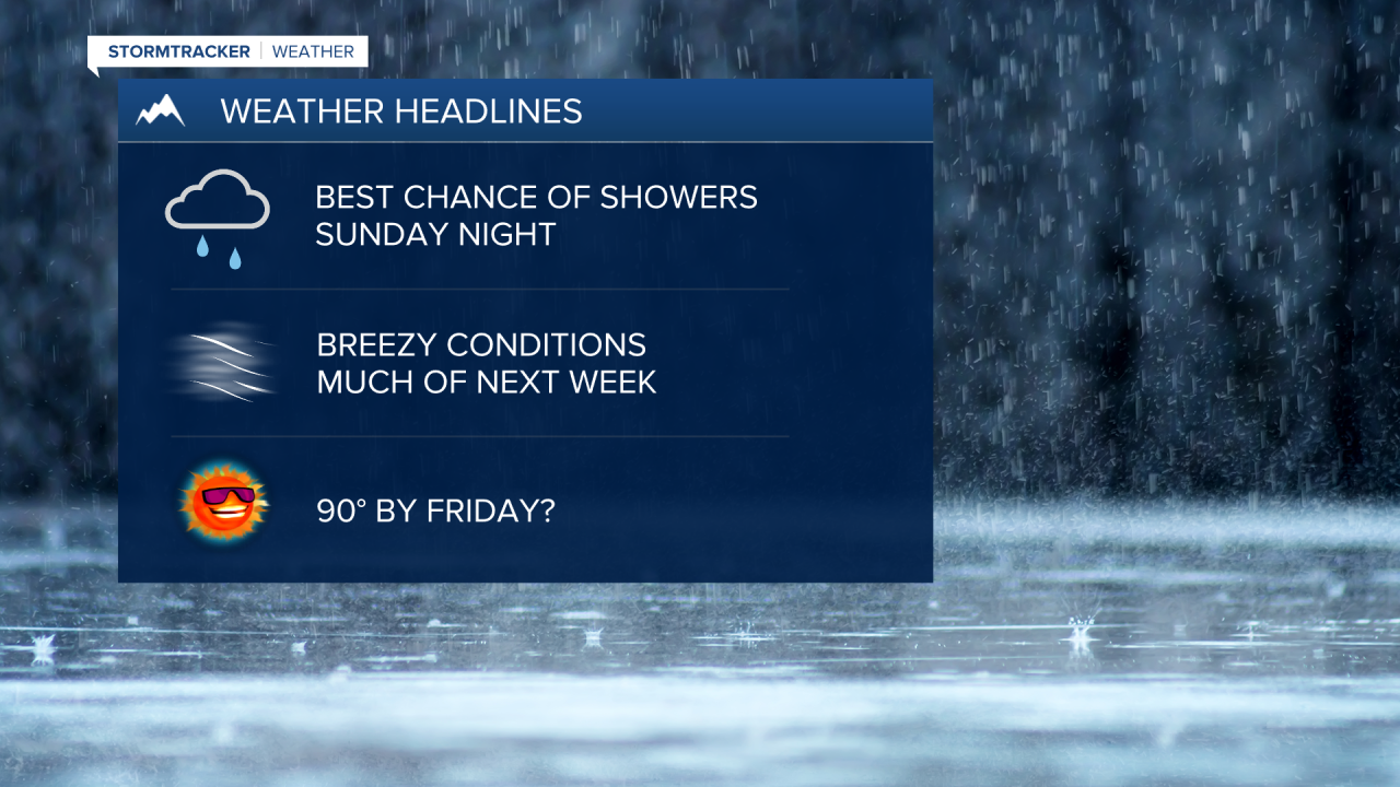
Sunday: Showers develop during the afternoon and evening. The heaviest precipitation will be in southwestern Montana and the Helena area. Otherwise, partly to mostly cloudy skies can be expected. High temperatures will reach the low to mid 70s. Showers continue overnight, especially for north-central Montana. Temperatures will fall into the upper 40s.

Monday: Mostly cloudy with scattered showers around. A westerly breeze sustained at 15-20 MPH gusting to 35 MPH at times. High temperatures in the low to mid 60s. Scattered showers continue overnight as temperatures fall into the lower 40s.
Tuesday: Showers likely. Otherwise, mostly cloudy skies. A WSW breeze at 20-25 MPH gusting to 40 MPH. Rain showers taper overnight as temperatures fall into the lower 40s. Breezy conditions persist overnight.
Wednesday: Mostly sunny and breezy. High temperatures on either side of 70 degrees. Mostly clear overnight as temperatures fall into the lower 40s.
Thursday: Sunny and mild. High temperatures in the lower 80s. Overnight low temperatures in the lower 50s.
Friday: Sunny and hot. Highs in the upper 80s to around 90 degrees. Overnight low temperatures in the mid to upper 50s.
Saturday: Mostly sunny. Slight chance for an afternoon shower or thunderstorm. Highs in the lower 80s.
