Temperatures remain on tack with average as we enter a new work week.
Another round of dense fog will start your day out with reported visibility less than a mile in many areas.
The fog is expected to begin lifting mid morning and should be out of the area by 11am.
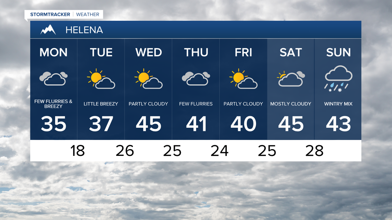
A few light flurries are possible throughout the day, with most remaining in the mountains.
The wind will begin to pick up this afternoon and increase on Tuesday with gusts reaching 30 mph.
The wind will drive the temperatures back into the 40s for most of the state.
Wednesday will offer up partly sunny skies with highs in the mid 40s.
A cold front is expected to pass through the state on Thursday.
This front will allow for a few spotty flurries and very cold temperatures Thursday night.
Friday will remain a bit cooler with highs in the low 40s.
Strong incoming high pressure will allow for very mild temperatures this next weekend.
Highs in the upper 40s and low 50s are likely on Saturday and Sunday.