


A weak weather disturbance moving through this morning will bring our only chance for precipitation during this first week of February. Highs on Tuesday will reach the 40s and 50s, with decreasing clouds and lighter winds.


Today's Forecast:
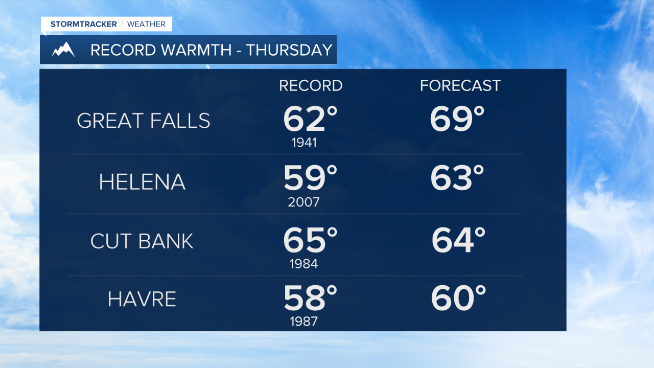
This time last year, temperatures dropped below zero for over two days, and frigid weather persisted throughout much of the rest of the month. In contrast, this year a strong ridge of high pressure will bring unusual, record-setting warmth for February from Wednesday through Friday. There’s even a chance we could tie or set a new record for the warmest temperature ever recorded in February for Great Falls. The current record stands at 70°, set in 1992. Highs will be in the 60s and lower 70s each day, with mostly sunny to partly cloudy skies.
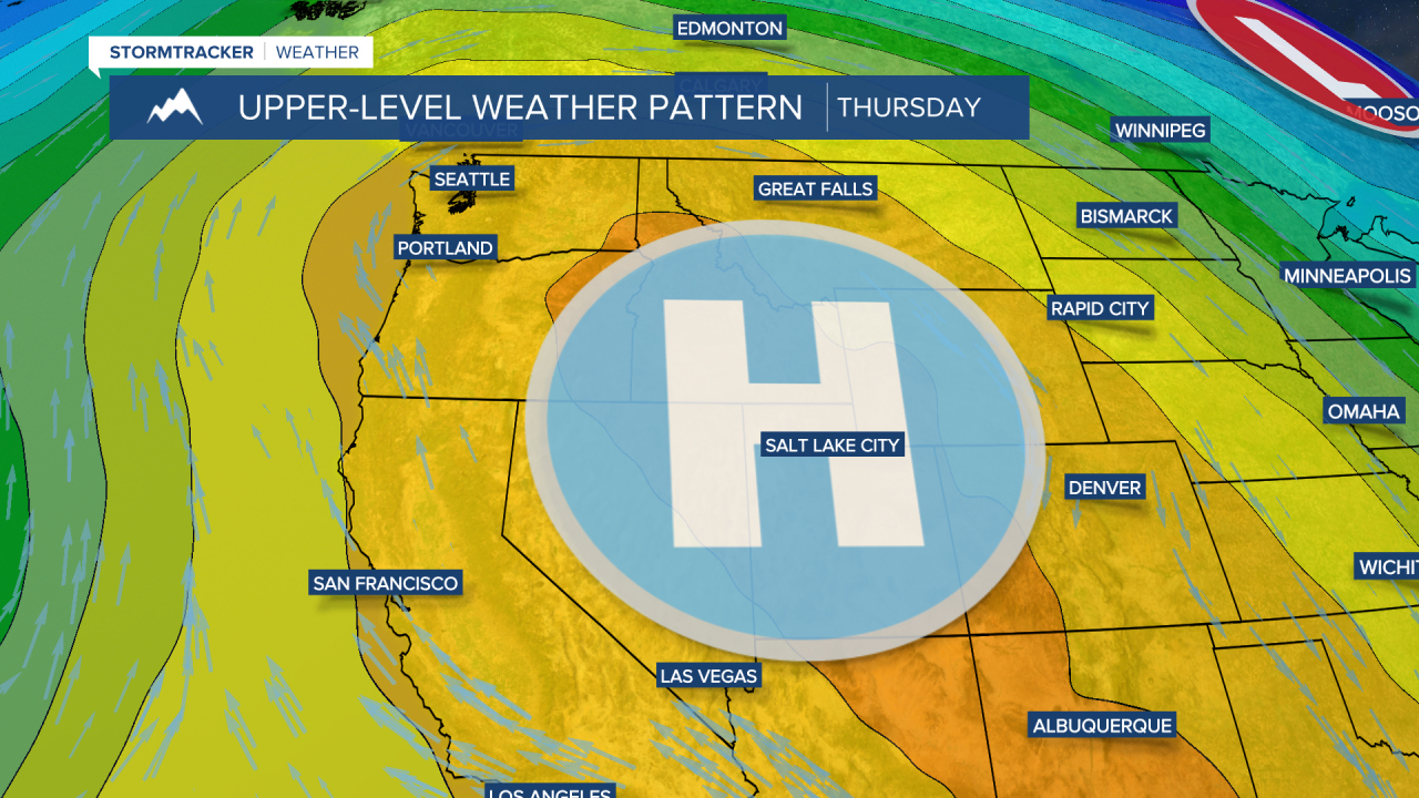
The wind picks up, especially on Thursday and Friday. Along the Rocky Mountain Front, gusts could exceed 50 mph, and east of the Rocky Mountain Front, gusts could reach around 40 mph. The combination of lower humidity and warmth raises concerns about grassland fires.
Temperatures will cool slightly into the upcoming weekend, but still well above average, with highs in the 50s and lower 60s. A weak system may bring a few scattered showers and cooler temperatures in the 40s early next week.


