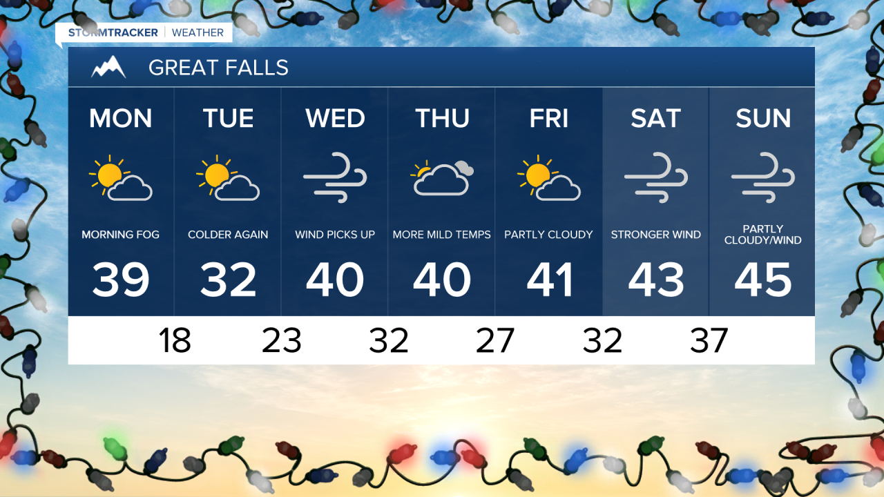
Fog is expected to blanket a good portion of North Central Montana Monday morning.
The fog should lift out of the region by ten this morning.
Temperatures will trend a bit warmer Monday compared to Sunday.
The warmer temperatures are thanks to a weak ridge of high pressure that will briefly visit the state today.
As skies clear up daytime highs are expected to range from the mid 30s to early 40s.
Some wind is possible this afternoon with gust around 20 mph.
Colder air is on track to move in overnight, allowing for temperatures to fall to the teen.
Tuesday will remain more average with highs in the low 30s for most.
The wind is expected to begin picking back up on Wednesday.
The wind and incoming high pressure will allow for daytime highs to climb back above average.
A quick moving cold front will open the door for a few flurries on Thursday.
Little to now accumulation is expected throughout the lower elevations.
Forecast models are suggesting that stronger wind will take us through the weekend.
The increase in wind will drive temperatures well above average through Sunday.