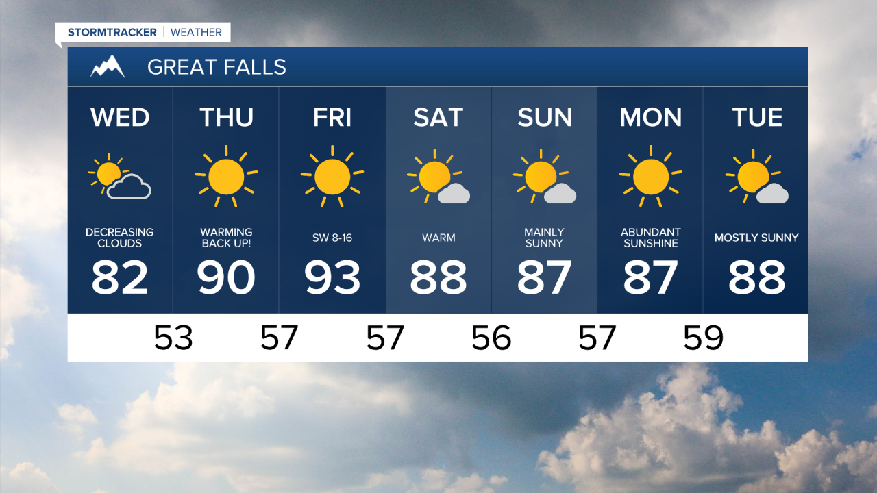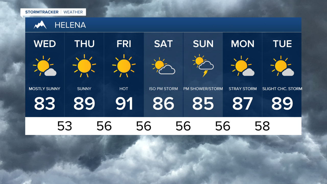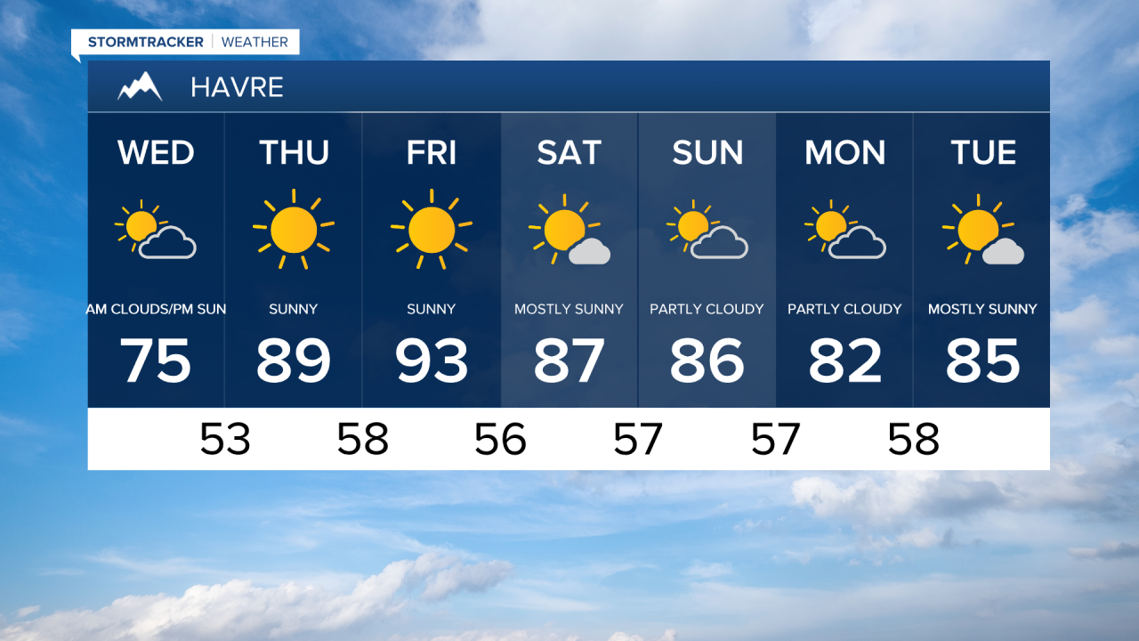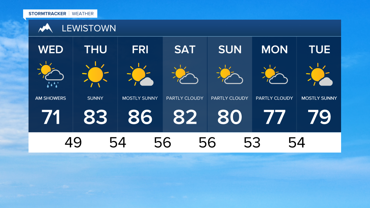


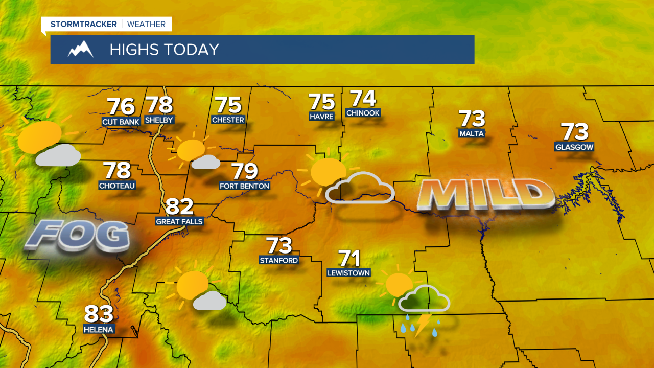
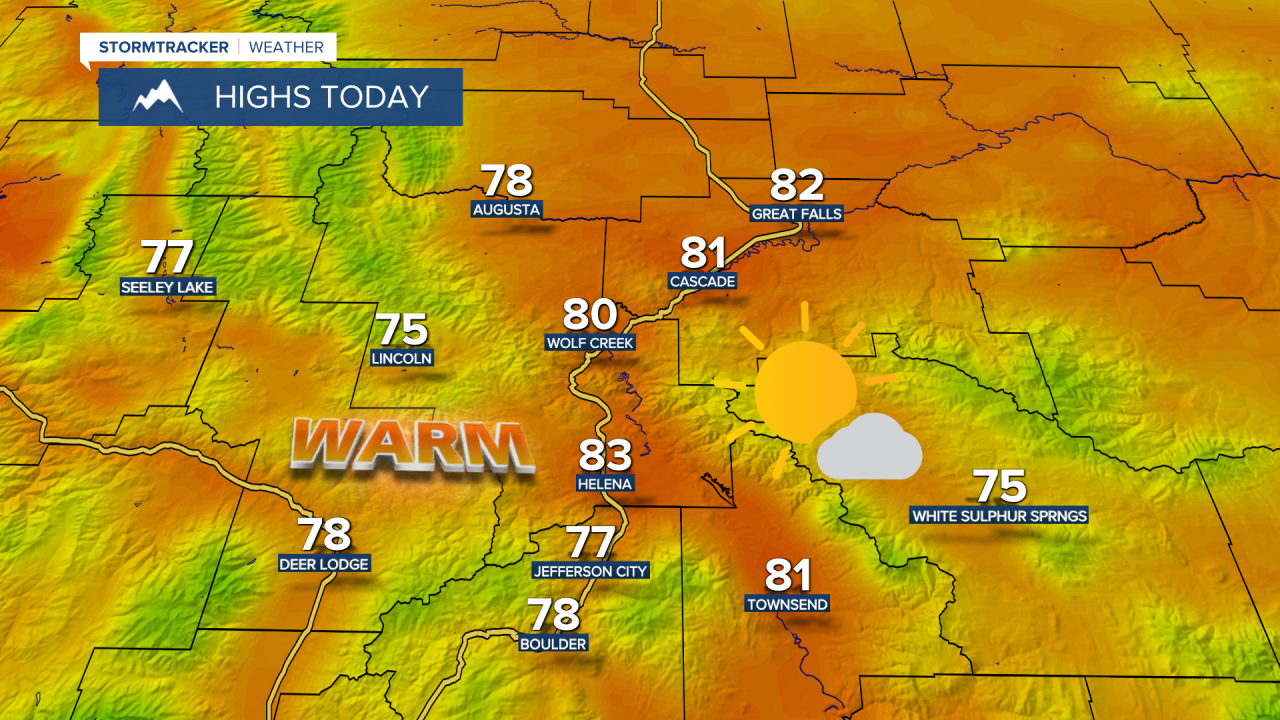
Calm wind and abundant low-level moisture is leading to low clouds and areas of fog, but we will gradually clear out throughout our Wednesday. Lingering showers and thunderstorms will continue over Fergus County and areas east of Havre on the Hi-Line. The sunshine will warm us up into the upper 70s and low 80s. Aside from a 10 to 20 mph breeze for the Rocky Mountain Front, there is going to be little to no wind across the rest of the area.
After the cool and wet weather, we'll dry out and warm up for Thursday and Friday. Highs will climb into the upper 80s and low to mid 90s. Stronger breezes will return with wind speeds between 10 and 25 mph.
If you're headed out to the Montana State Fair this weekend, it will stay very warm with high temperatures in the mid to upper 80s. There is a slight risk for a shower or thunderstorm, mainly in the mountains and for areas east of I-15, both Saturday and Sunday.
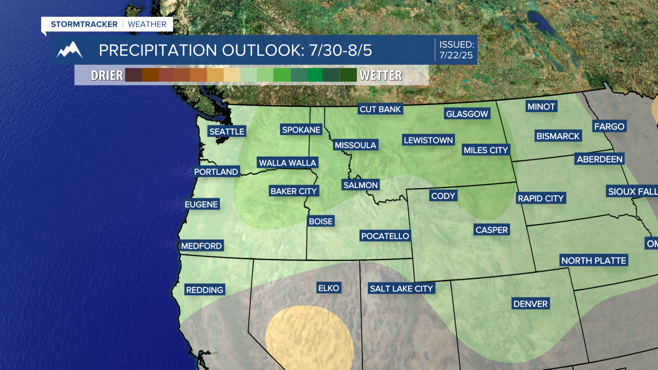
Daily chances for showers and thunderstorms heading into next week as we return to a more active weather pattern. Temperatures will stay seasonably warm in the 80s and lower 90s.