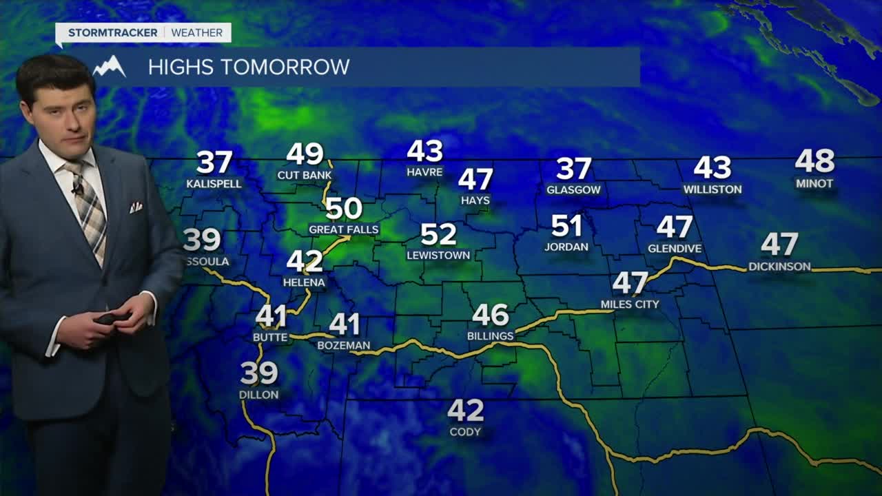


Skies continue to clear on Wednesday and temperatures will return to the low 40s.
The day will start out on chilly side before gradually warming above average this afternoon.
Northeastern Montana will remain colder with highs in the mid 30s.
The wind is expected to remain minimal today and begin to ramp back up on Thursday.
Gusts around 20 mph are likely for most of Central Montana on both Thursday and Friday.
As per usual stronger crosswinds are likely along the immediate vicinity of the Rocky Mountain Front.
High pressure will allow for the high to remain in the upper 40s and low 50s through Saturday.
A weak area of low pressure will allow for slightly cooler air to invade on Sunday and Monday.
Temperatures will however remain in the mid 40s with just a slight increase in cloud cover.


