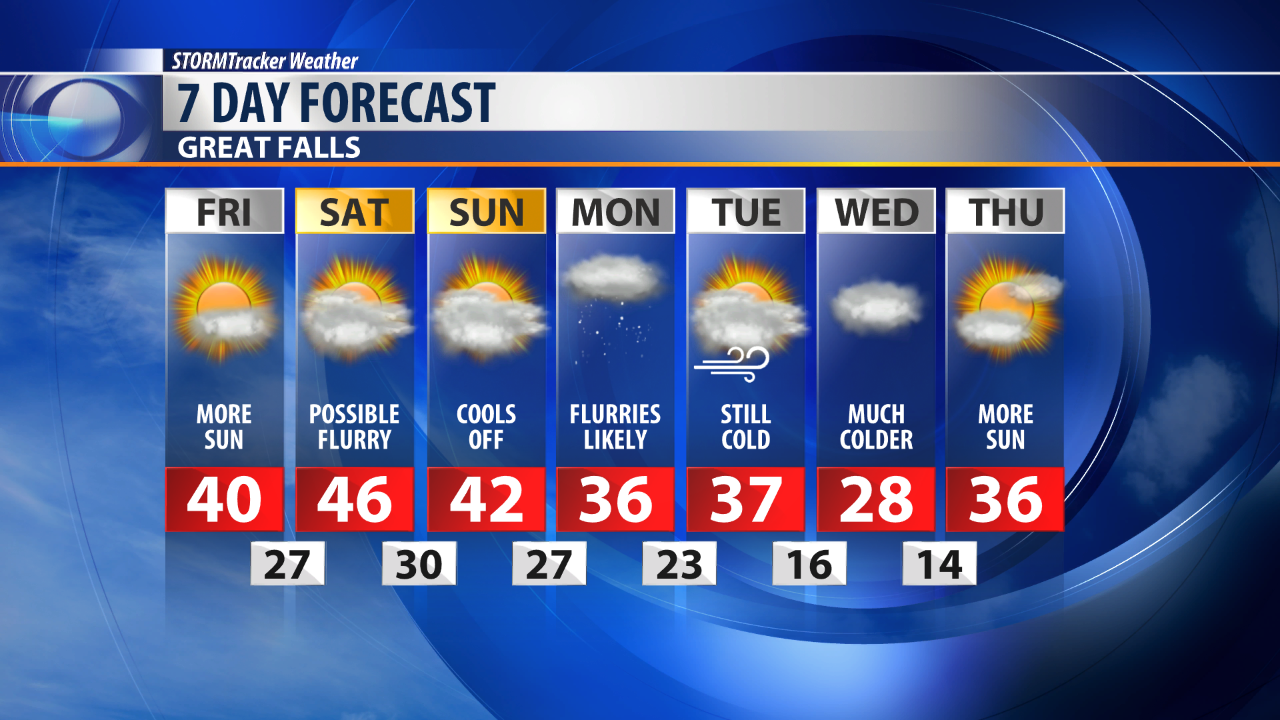
High pressure will allow for more sun on Friday and temperatures to once again reach the 40s for most.
Although not overly windy, breezy conditions are expected through the weekend.
A few spotty flurries can't be ruled out on Saturday, however most of the moisture will remain in Eastern Montana where rain is likely.
Clouds will continue to build on Sunday ahead of out next weather maker.
This system will move in late Sunday afternoon and last through Monday.
Snow flurries are likely along with stronger wind.
Accumulations are expected to be less than an inch for most.
Blowing and drifting snow will be the main concern with the passage of this system.
Another shot of cold air is expected late Tuesday night.
This cold front will ramp up the winds significantly and likely offer up a better chance of snow accumulation.