

Good Tuesday morning! Another warm, dry and beautiful day ahead in central and eastern Montana. Highs will be in the mid to upper 80s today and Wednesday. We will have mainly sunny skies today, and then increasing clouds on Wednesday.
First look at Labor Day weekend in today's forecast:
An east-northeast breeze continues to push most of the smoke into western and southwest Montana for the next couple of days. Although, some smoke may move in and out of Helena as the wind shifts over the coming days.


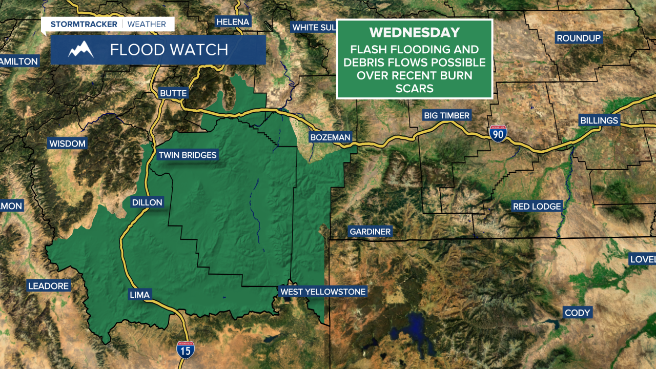
A monsoon is currently impacting the West. This occurs when a high-pressure ridge sets up near the Four Corners. Air flows clockwise around the high, drawing in tropical moisture from the Gulf of California and the eastern Pacific. As this moisture interacts with the terrain and is fueled by hot temperatures, it creates perfect conditions for heavy showers and thunderstorms. This is a yearly occurrence and not unusual, typically in late summer in the southwestern United States.

While the monsoon generally has a greater impact on states to our south, some of that remnant moisture will sneak its way into Montana. Showers and thunderstorms are expected in southwest Montana from today through Friday, mainly on Thursday and Friday for Helena and central Montana. The Hi-Line will receive little to no precipitation. The main impact we'll feel here in central Montana is increased cloud cover, scattered showers and cooler temperatures. Highs will be in the 70s on Thursday and Friday in central Montana and upper 70s and lower 80s for the Hi-Line.

Beautiful weather in the forecast for our Labor Day weekend. We can expect mostly sunny skies and warm temperatures. Highs will be in the upper 70s to mid 80s. There's just a slim chance of a shower or thunderstorm each afternoon.


