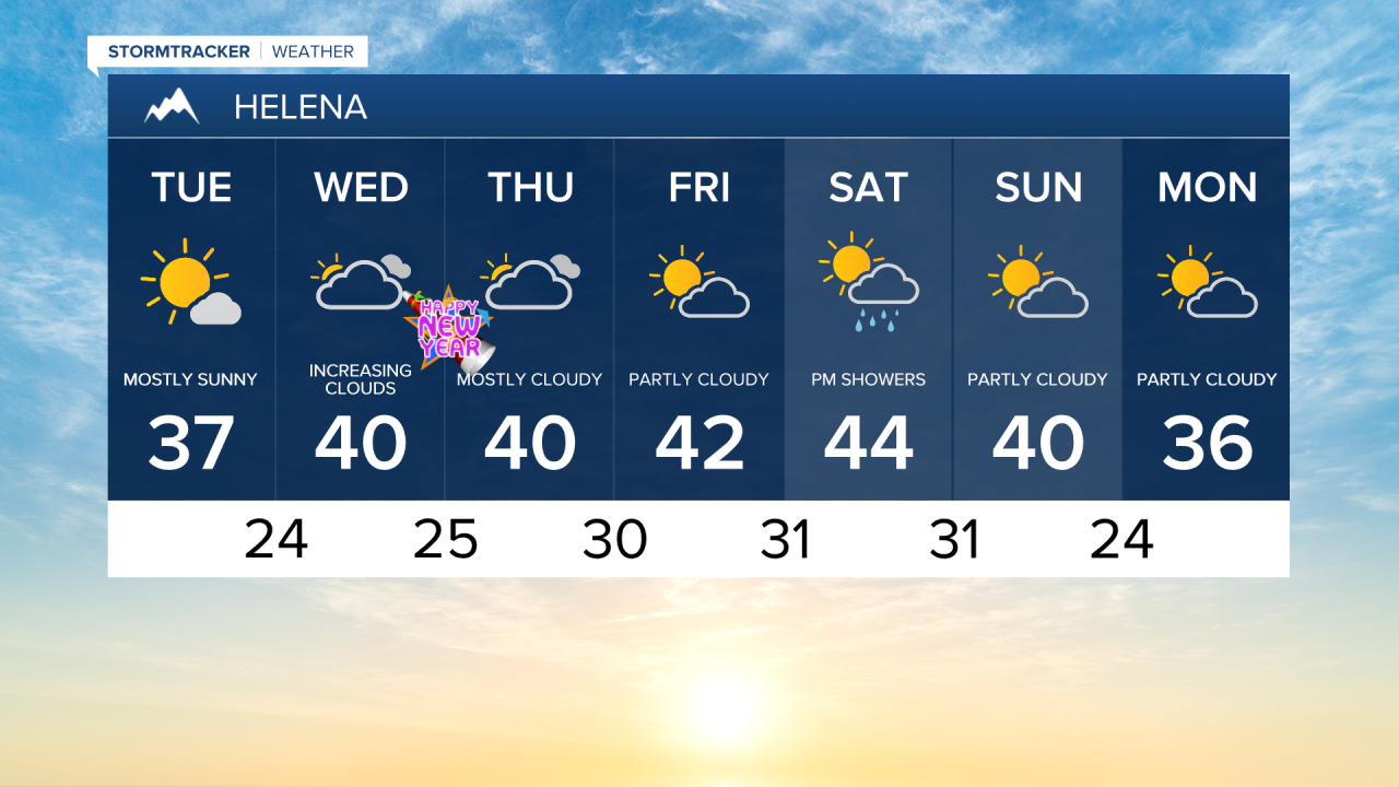
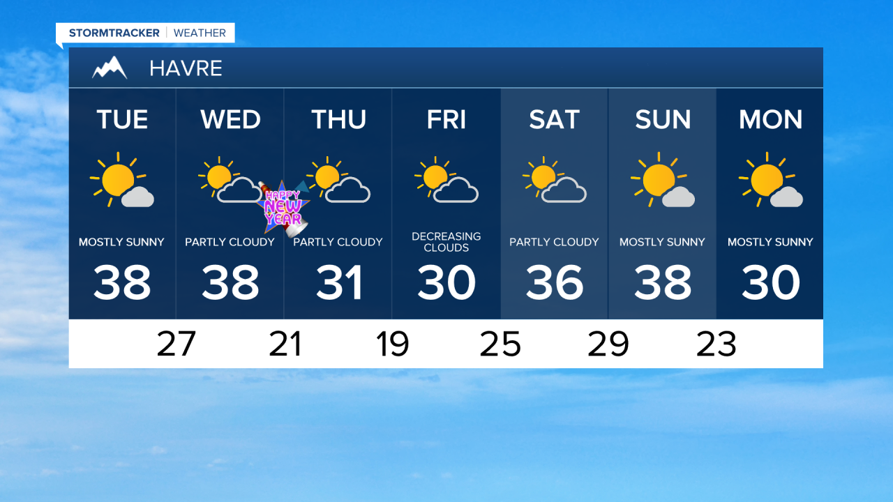
After Arctic air and some snow this past weekend, temperatures warmed up nicely yesterday, reaching the 30s and 40s. Seasonably mild temperatures will continue through the end of the year into 2026. High temps into the 30s on the Hi-Line and 40s south of the Hi-Line.
Today's Forecast:
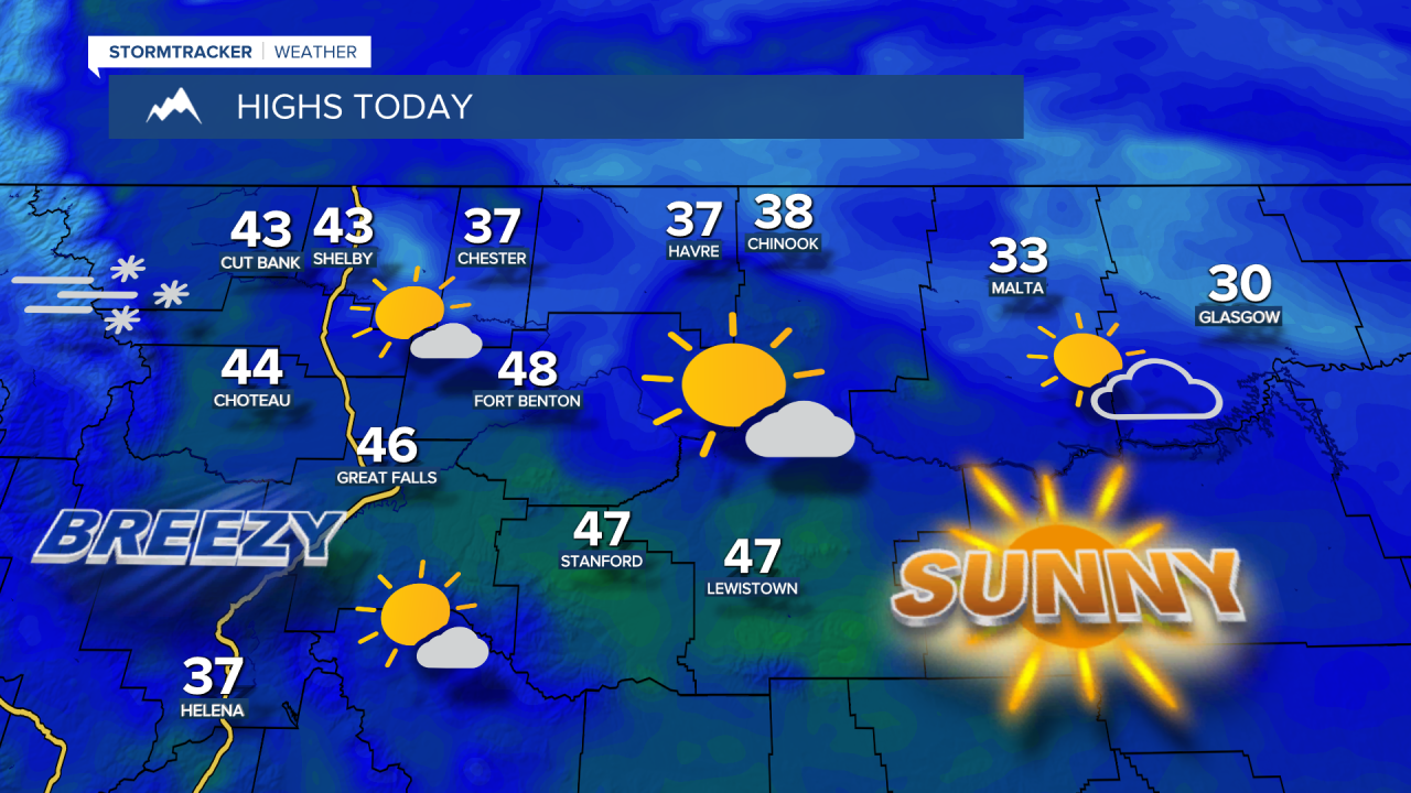

Gusty conditions also persist across East Glacier National Park and the adjacent foothills and plains. A High Wind Watch is in effect from this evening through Wednesday morning. Strong wind gusts of 60-70+ mph are possible in these areas.

New Year's Eve will be milder in central Montana, with temperatures in the upper 40s to lower 50s. A backdoor cold front will keep temperatures colder on the Hi-Line, with readings in the 20s and 30s.
New Year's Day 2026 will start with some rain, along with mountain snow moving in along and west of the Continental Divide. High temperatures will be in the 20s and 30s on the Hi-Line and in the 40s south of the Hi-Line.
Seasonably warm and mostly dry conditions are expected to continue into the weekend.