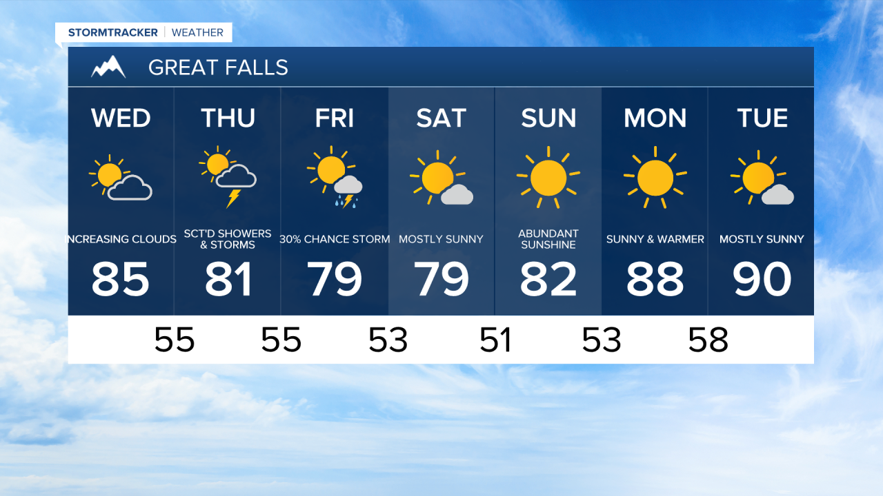
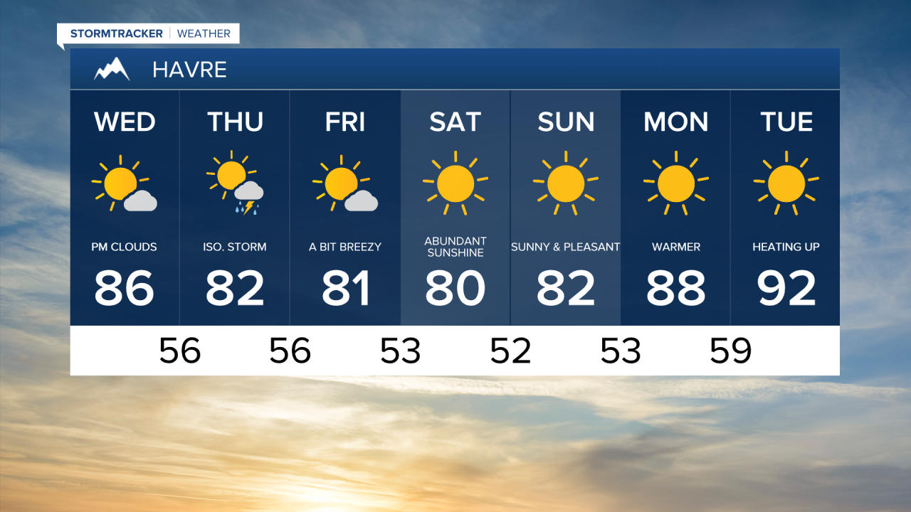
After a warmer Tuesday, today's weather will look fairly similar across Montana. A bit of haze is giving the sky a milky appearance, courtesy of a couple of large fires burning in southern Utah. Increasing clouds with afternoon temperatures reaching the low to mid 80s.
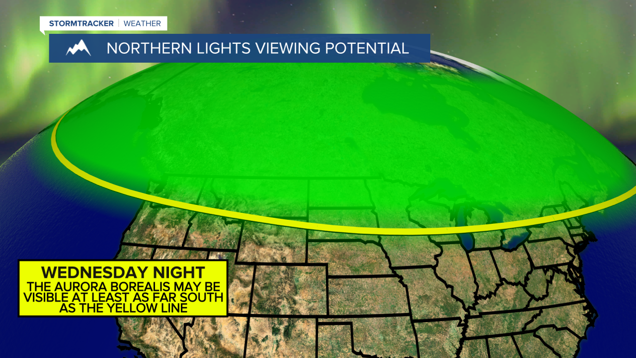
There's a chance to see the Aurora Borealis overnight in Montana:
Isolated thunderstorms are likely again this afternoon and evening across eastern Montana, where the Storm Prediction Center has issued a Level 1 risk for severe weather. The main threats are isolated damaging wind gusts and small hail.

A system moves in on Thursday, bringing the best chance for showers and thunderstorms this week, including a few isolated severe storms. Damaging wind gusts and small hail will remain the primary threats. There could still be an isolated shower or thunderstorm on Friday. Temperatures both days will be in the mid to upper 70s and low 80s. The passing system will also increase wind speeds, with sustained winds between 10 and 25 mph and gusts up to 30 mph through Friday evening.

A phenomenal weekend of weather is ahead, with sunshine and pleasantly warm temperatures. Highs will be in the 70s and low 80s, accompanied by a comfortable breeze of 10 to 20 mph. There may be an isolated shower or thunderstorm in the higher terrain.
Temperatures start to heat up next week into the upper 80s and lower 90s Monday and Tuesday. High pressure will provide us with more sunshine.