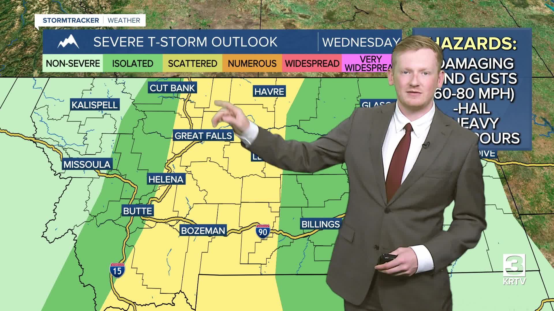


GREAT FALLS — The biggest threat will be damaging wind gusts of 60–80 mph, though an isolated storm could also produce large hail. Lightning may spark new fires as well. The bulk of the storms will move through between 2 and 9 p.m.
The cold front moves through Wednesday night with widespread strong winds developing across the entire area. Peak wind gusts will reach 50–60+ mph, with the strongest winds expected Thursday morning into the early afternoon.
If the live radar below does not load, click here.
Click here for current Weather Alerts.
Current Conditions
- Humidity: 94%
- Dew point: 53°
- Pressure: 29.75 in
- Wind speed: 12 mph
- Wind direction: WSW
- Visibility: 10.0 mi
- Sunrise: 05:31 AM
- Sunset: 09:26 PM
VIEWER VIDEO - HABOOB NEAR HAVRE:
Big Wind: rare haboob in Montana
