


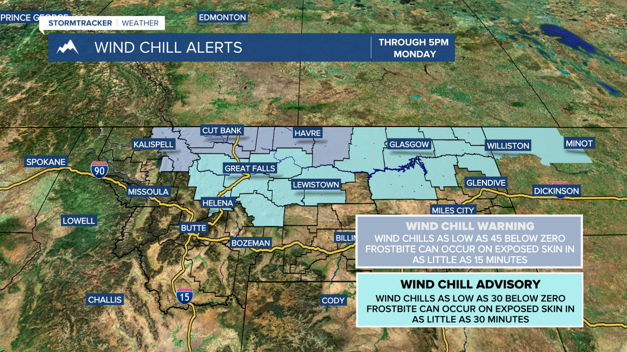
Sunday: A few, lingering snow showers are possible especially east of Great Falls. Northeastern Montana will see snow throughout much of the day, with 3-5 inches possible in far northeastern locations. Otherwise, mostly cloudy skies. Temperatures struggle to rise above 0 degrees in most locations. Wind chills will be between 10 and 30 below zero, especially after sunset. Temperatures fall to -10 to -30 at night, with wind chills as low as -45 for the Hi-Line.


Monday: Mostly cloudy skies and dangerously cold. Most locations will not reach 0 degrees throughout the day. Expecting a high of 5 below zero Monday. Monday night temperatures will fall to -5 to -25 with wind chills as low as -35 for the Hi-Line.
Tuesday: Mostly sunny to partly cloudy skies. Temperatures will be a bit warmer, ranging from 5 to 15 degrees. Overnight temperatures fall to -5 to -15 with wind chills as low as -20.
Wednesday: Mostly sunny skies. High temperatures in the upper single digits and over night lows 0 to -10 degrees.
Thursday: Snow showers are possible in the mountains, otherwise mostly cloudy skies. Milder temperatures with highs in the low to mid 20s. Overnight lows will fall into the single digits.
New Year's Eve: Scattered snow showers. Daytime high temperatures in the mid teens and overnight lows -5 to -10.
New Year's Day: A mix of sun and clouds. High temperatures in the low to mid 20s.
