


Overnight snow showers have led to slick roads in parts of Judith Basin, Fergus counties, and northeast Montana. A good part of Friday will be dry, but between 5 and 10 p.m., a band of moderate snow and gusty winds will move from east to west across the area. Watch for for quick reductions in visibility.
Today's forecast:
Light to moderate snow continues overnight, mixing with rain and freezing rain at times in the lower elevations. Meanwhile, heavier snow will fall in the mountains. Scattered snow showers gradually end on Saturday across central Montana, but some snow may continue into the night in the mountains and northeast Montana.

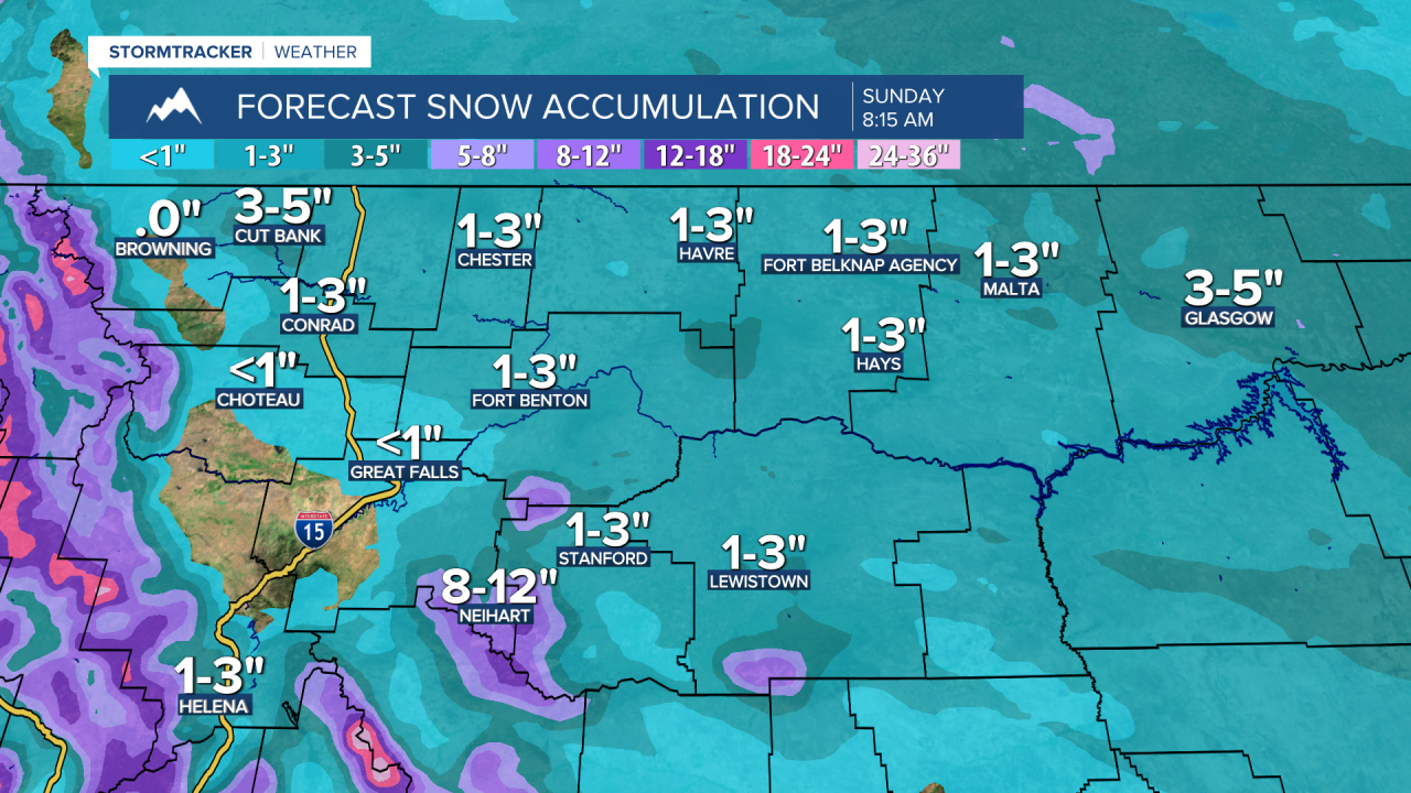
An additional 6 to 12 inches of snow is expected in the mountains of central Montana, with a foot or more along and west of the Divide. In the lower elevations, snow totals will vary: areas around Great Falls, Helena, and between may see just a dusting to an inch. However, Chouteau and Fergus counties, as well as the Hi-Line, could receive 1 to 3 inches. Along Highway 87/200 from Belt to Lewistown, snow totals may reach 3 to 6 inches.

Temperatures will drop into Saturday, with highs in the 10s in northeast Montana, lower 20s for the Hi-Line, upper 20s to lower 30s in central Montana, and lower 40s in the Helena area. Skies will be mostly cloudy and mostly dry on Sunday, with only a few mountain snow showers. Daytime highs in the 10s and 20s in northeast Montana, and in the 30s to lower 40s elsewhere.
Winds increase early next week, with sustained speeds of 10-30 mph and gusts over 40 mph. Daytime highs will be in the 30s and low to mid 40s.
Next week remains unsettled and turning milder as high temperatures will reach the 40s and low 50s. Snow will pile up in the mountains, while the lower elevations will just see scattered rain and snow showers.


