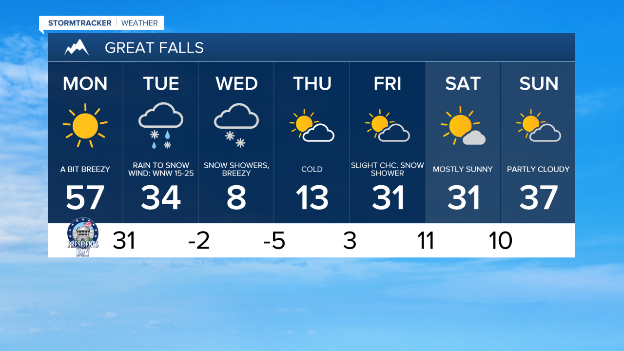
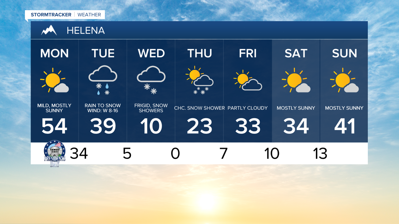
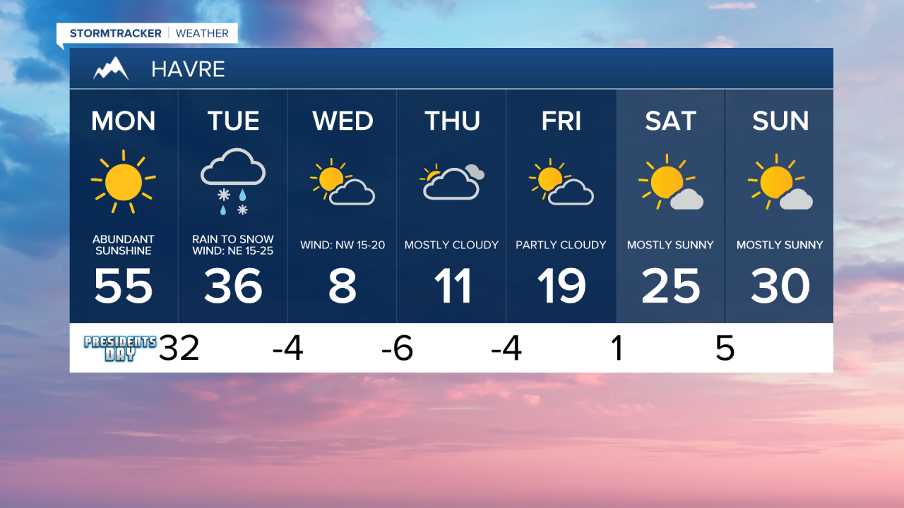
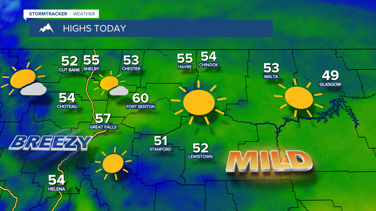
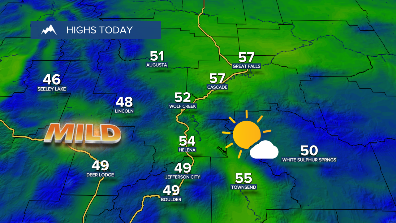
It will be another unseasonably warm day across Montana on Monday ahead of a strong cold front. Daytime highs will reach the 50s and low 60s.
Today's Forecast:
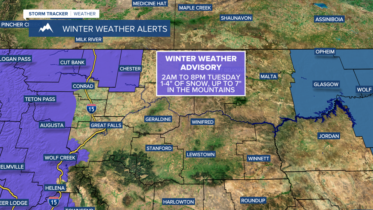
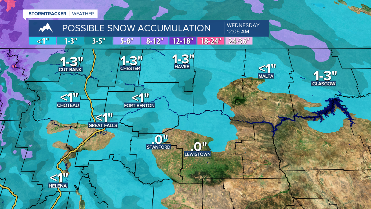
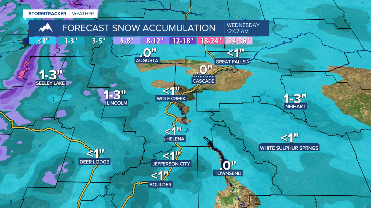
Wintry conditions are set to return starting Tuesday as a series of systems move through the region. A wave of rain and snow will arrive, switching over to all snow throughout Tuesday morning. Along the front, there could be some bursts of snow, reducing visibility. Temperatures will fall from the 30s in the morning to the 10s and 20s by evening. Snow accumulations will be fairly light in the lower elevations, but paired with wind gusts of 30-40 mph, visibility could be low at times, and roads may be slick throughout Tuesday. As the system moves into eastern Montana Tuesday night, wind gusts of up to 50 mph and 1-4 inches of snow could create near-blizzard conditions across northeast Montana.

Behind the system, northwest winds will pull in very cold air for Wednesday and Thursday, with high temperatures only reaching the 0s and lower 10s on Wednesday, and the 0s to 10s on Thursday. Overnight temperatures will fall below zero, and wind chills could dip as low as the -10s and -20s on the Hi-Line.
High pressure will build back in by the weekend, bringing temperatures back into the 30s and 40s with sunshine.