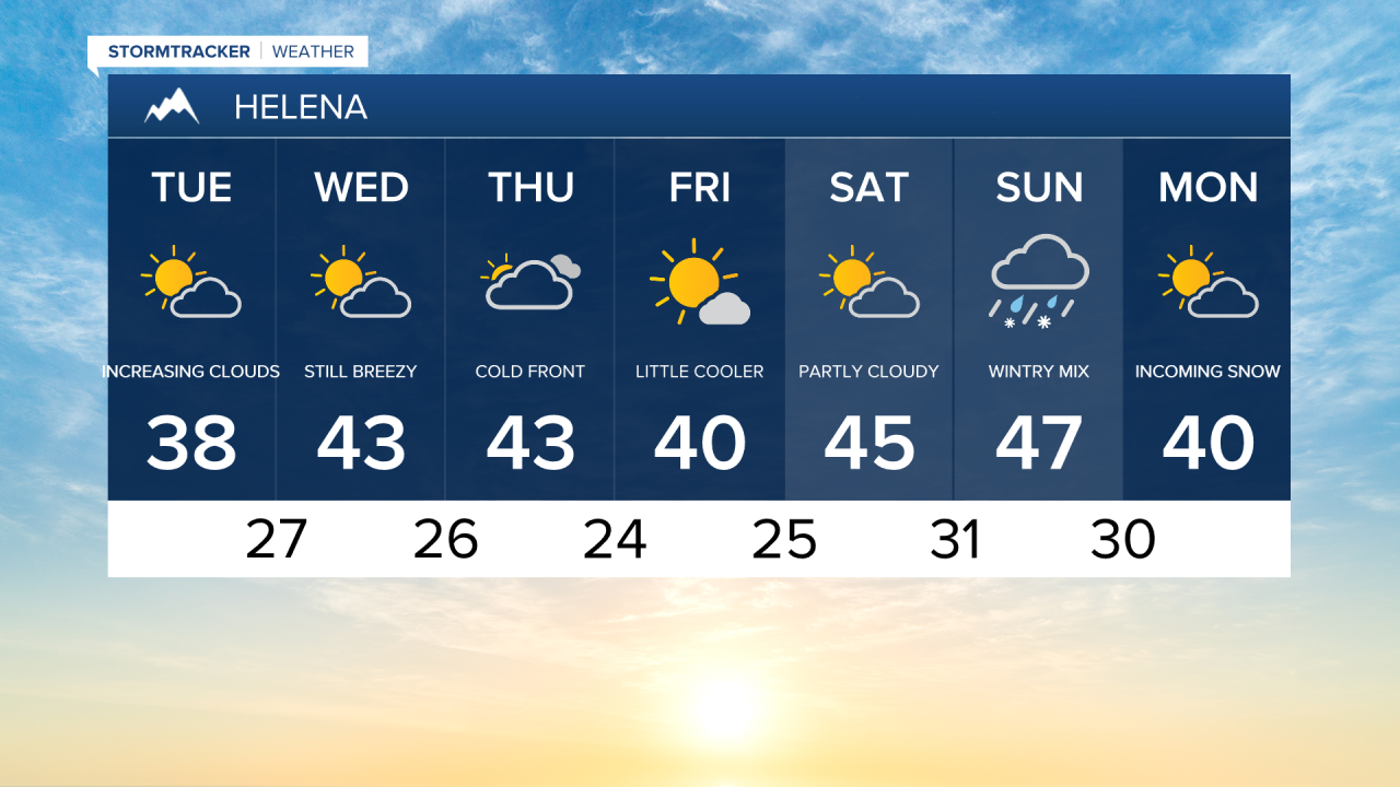
Strong wind will take over on Tuesday driving temperatures back above average.
A few mountain flurries remain a possibility, primarily west of the Continental Divide today.
As high pressure begins to build over the state the wind will kick up significantly this afternoon.
Gusts over 30 mph are likely for all of Central Montana with stronger gusts in the immediate vicinity of the Rocky Mountain Front.
Wednesday will offer up partly sunny skies, brisk wind, and highs in the mid 40s.
A cold front is expected to pass through the state on Thursday.
This front will allow for a few spotty flurries and more gusty wind.
Very cold temperatures are expected Thursday night following the passage of this front.
Friday will remain breezy and a bit cooler with highs in the low 40s.
Strong high pressure will allow for the very mild temperatures to continue this weekend.
Highs in the upper 40s and low 50s are likely on Saturday and Sunday.
Forecast models are suggesting that the above average temperatures will come to an end early next week.
Colder air from Canada is expected to drop into the state and meet up with Pacific Moisture on Monday.
This will open the door for much colder temperatures and some snow as Christmas approaches.