


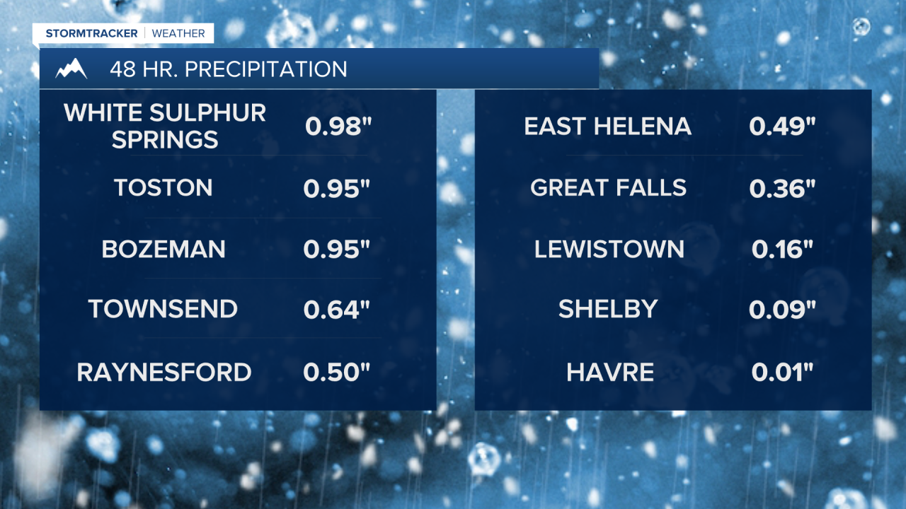
The late week storm really overperformed in some areas bringing some beneficial and much-needed moisture. Discovery Ski Area picked up at least 16" of snow, and several mountain ranges along and west of the Divide received over a foot of snowfall. Totals were significantly lower further north, into north-central Montana and the Hi-Line.

Today's Forecast:
The storm departs the area on Friday, with highs in the 40s to near 50. Expect mostly sunny skies into the afternoon and increasing wind, especially near the Rocky Mountain Front.


High Wind Warnings begin tonight and last through Sunday night for the Rocky Mountain Front, with gusts reaching 65-85+ mph. High Wind Watches are in effect for the daytime hours of Saturday and Sunday east of the Rocky Mountain Front across the plains with gusts of 50-60+ mph. The strongest wind gusts are expected on Sunday. Temperatures warm up with the strong winds, with highs in the 50s and 60s.

A cold front moves into the Hi-Line Sunday evening, bringing a few rain and snow showers. Colder air will move in on Monday, with highs in the 30s and 40s. The rest of the week will stay cooler, with chances for accumulating snow even in the lower elevations.


