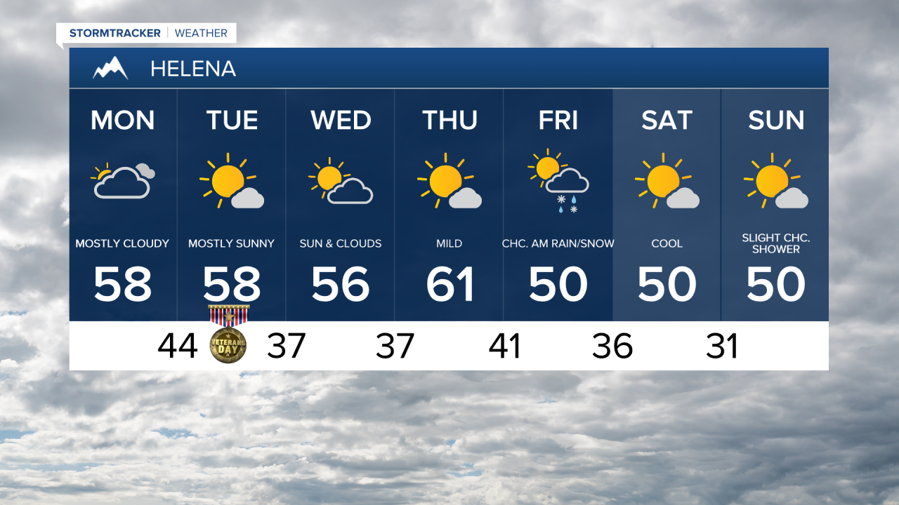
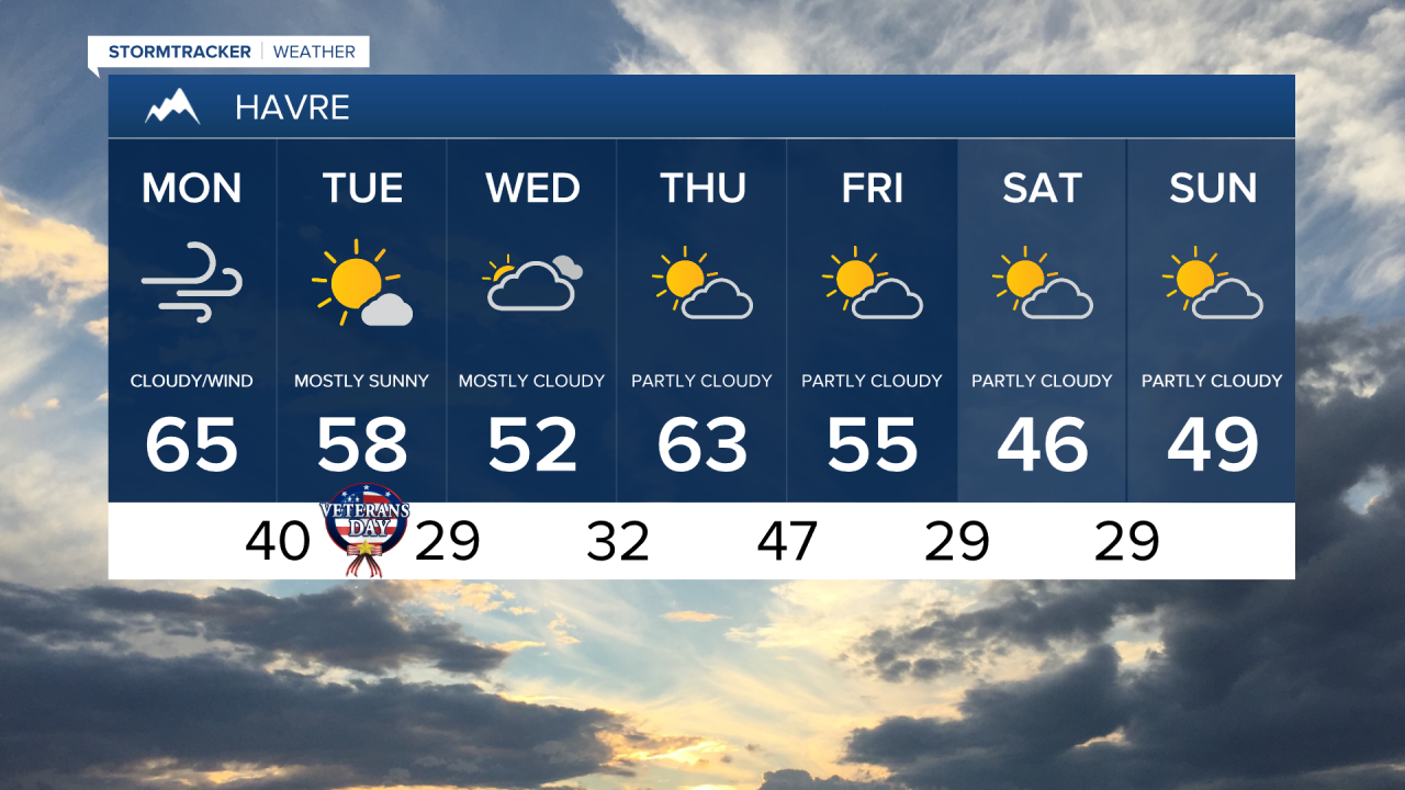
A Chinook wind is bringing unusually warm temperatures this morning. After temperatures were in the 10s and 20s yesterday morning, many areas in north central Montana are now in the 50s and low 60s. This is already 15 to 20 degrees above the normal high temperature for this time of year, and we could challenge record highs later this afternoon.
Here's the detailed forecast:
A big ridge of high pressure is building into the West, setting us up for a warm and windy start to the week. Expect mostly cloudy to overcast skies and dry weather, with highs climbing into the 60s on Monday, well above average for this time of year. An isolated rain or mountain snow shower is possible along the Continental Divide.
High winds are expected again throughout the day for areas west of I-15 towards the Rocky Mountain Front. A High Wind Warning is in effect until 9 p.m. Monday for the Rocky Mountain Front and adjacent foothills and plains as southwest/west winds will be sustained at 35-50 mph with gusts up to 75 mph. Gusts of 35-50 mph are possible further east across the plains.

Dry and unseasonably mild conditions continue throughout the workweek. High temperatures will be in the upper 50s and lower 60s on Veterans Day with more sunshine and continued gusty conditions.
Partly to mostly cloudy skies and unseasonably mild temperatures with high temperatures in the upper 40s and lower 50s in eastern Montana and mid to upper 50s in central Montana on Wednesday and then low to mid 60s on Thursday.
Little to no rain or mountain snow is expected until Friday, when our next system begins to move in bringing cooler temperatures and increased precipitation chances. Highs will fall into the upper 40s and lower 50s for the weekend.