Happy Thanksgiving Montana! A lot happening in the forecast the next few days. It was a frigid start on the Hi-Line. Temperatures dipped below zero in several towns, Scobey was the coldest spot in the nation at -11°. Freezing fog is causing slick roadways in Chouteau County and across northeast Montana.

Today's forecast:
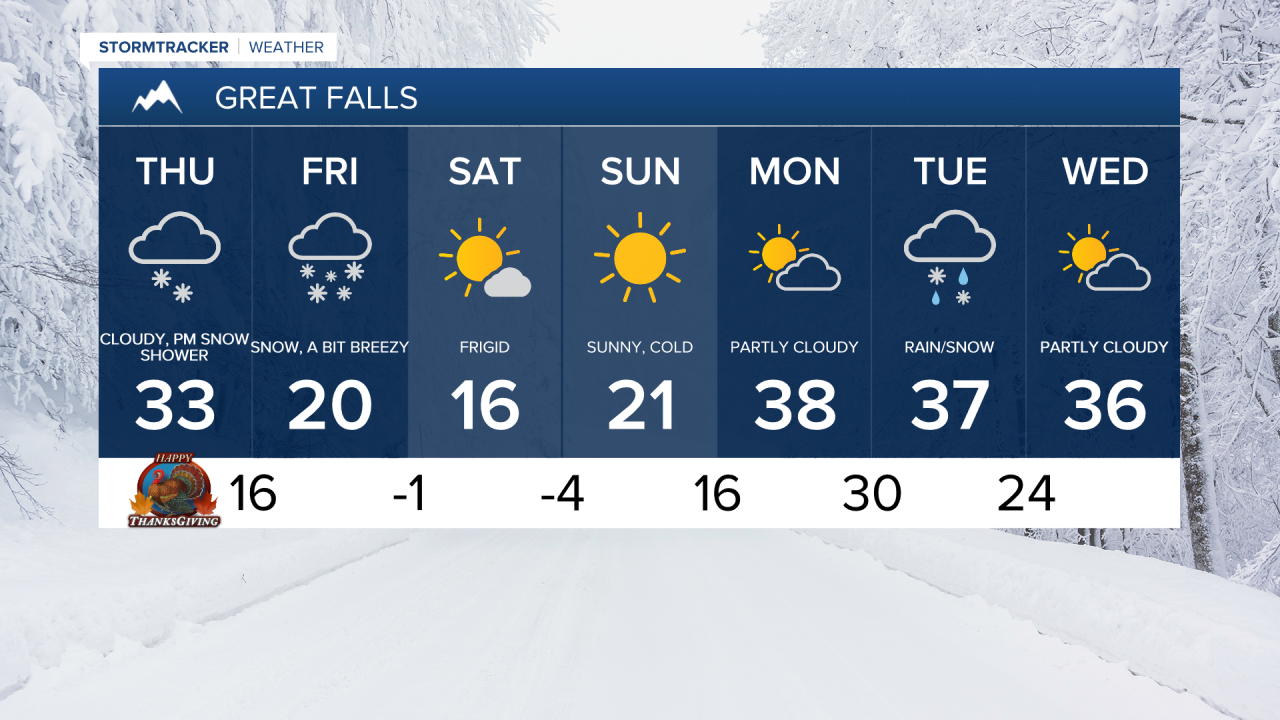
Highs will be in the upper 10s and 20s for the Hi-Line, low to mid 30s in central Montana and upper 30s and lower 40s for Thanksgiving Day.
Major travel issues are not anticipated today, but snow is going to move into northwest Montana and Glacier County this afternoon. That snow slowly spreads southeast across the rest of central Montana after sunset, so road conditions gradually deteriorate throughout the night. In Helena, the precipitation starts as rain before changing over to snow Friday morning.
Widespread snow showers continue overnight through the day Friday. Post-Thanksgiving travel is going to be difficult on Friday as most areas will have snow-packed, slick roads. Wind gusts of 25-35 mph out of the north causing blowing and drifting snow. Daytime highs will be significantly colder on Friday in the 10s and 20s.
- Road Conditions: click here
- MDT Webcams: click here
- MTN Cameras: click here
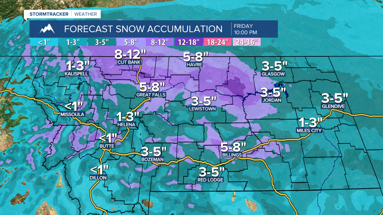
Here are the expected snow totals through Saturday morning:
The National Weather Service has issued Winter Storm Watches, Warnings and Advisories across the region. The Winter Storm Watch will likely be upgraded to a warning or advisory sometime today.
A frigid weekend ahead with high temperatures in the 0s and 10s and subzero wind chills a lot of the weekend. However, we will get some sunshine both days.
Temperatures rebound next week and rain/snow chances return by Tuesday.