


Winter has finally made its return, with snow falling across the Hi-Line and mountain regions this morning. Showdown has received over 4 inches of snow so far. Today, a variety of precipitation is expected across the area, primarily snow on the Hi-Line, with possible mixing of freezing rain and sleet at times. Any freezing rain could create very hazardous travel conditions. Rain showers will transition to snow this evening as a cold front moves south across Montana. Snow will also accumulate in the mountains throughout the day.
Today's forecast:
Daytime highs in the 30s for the Hi-Line and 40s in central Montana, falling into the 20s and 30s by evening. Winds get stronger during the morning and afternoon, with gusts of 40-50+ mph across central Montana.
The highest snow totals are forecast in the Glacier region and northeast Montana near the international border, where up to 8 inches of snow are possible. The storm system will move out of Montana and into the Dakotas tonight.
A pleasant but chilly Tuesday, with high temperatures in the upper 20s in northeast Montana and 30s for central Montana. Mostly sunny to partly cloudy skies throughout the day.
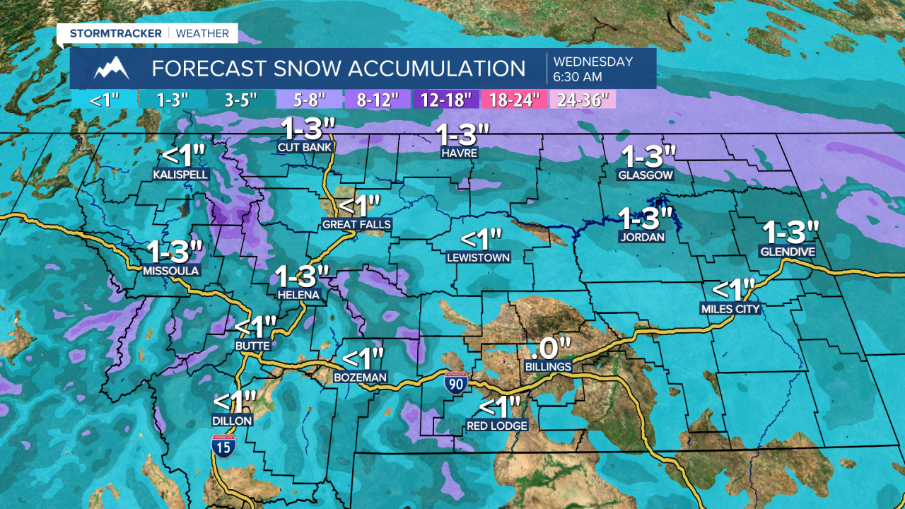
Late Tuesday night into Wednesday morning, another disturbance may trigger light snow showers in western Montana, particularly around Helena and between Great Falls and Helena, with minor accumulations expected. Highs will be in the 20s along the Hi-Line east of Havre and in the 30s to around 40 in central Montana.
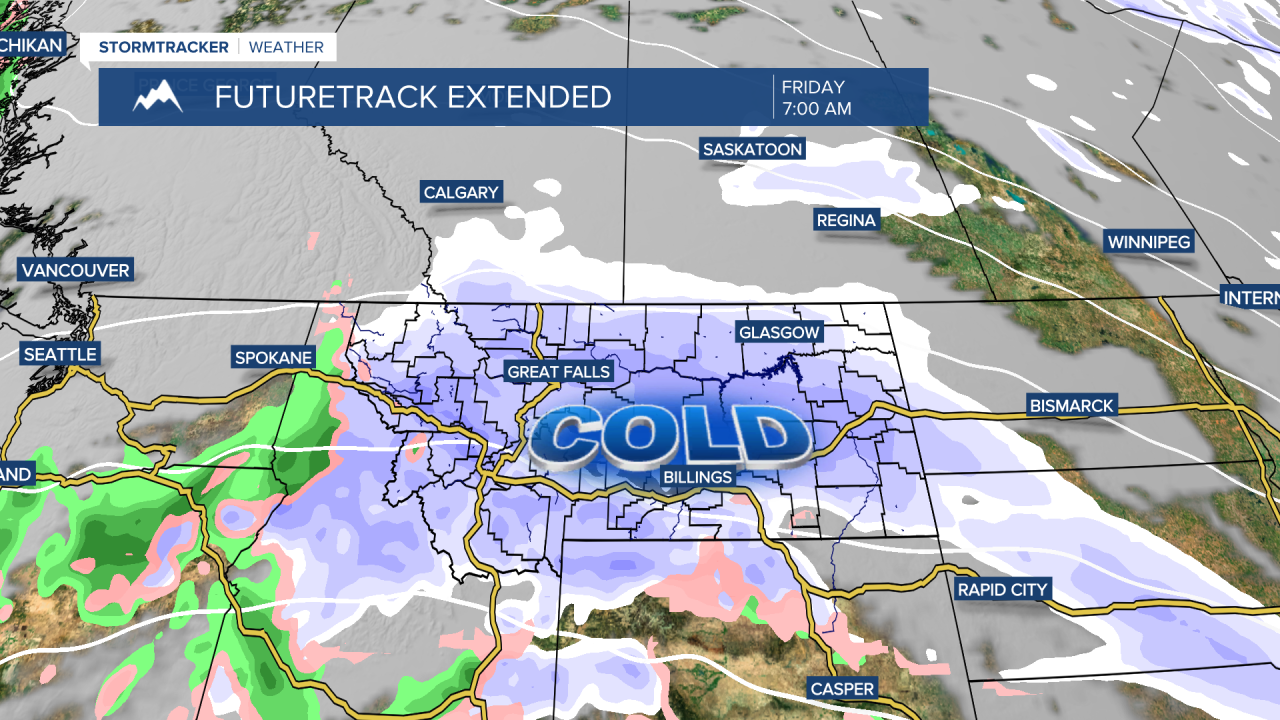
Our next system could be potentially impactful for holiday travel, with snow and colder temperatures arriving on Thanksgiving Day. Snow showers develop in the evening, with widespread snow expected overnight into Friday morning, potentially bringing our first significant accumulation to central Montana. Behind this system, frigid air will settle in, with high temperatures in the 10s and 20s and some areas experiencing their first subzero nighttime lows of the season.


