We saw a very windy Tuesday over central Montana. This morning, winds have eased some, but gusty conditions are set to return to the Rocky Mountain Front and portions of central Montana later today through Thursday. Scattered light rain, freezing rain and snow have been falling east of I-15. Be extremely careful on the roads, steps and sidewalks. A Winter Weather Advisory is in effect through 11 a.m.

Today's Forecast:
The strongest winds will be focused over the Rocky Mountain Front out to I-15 and along the US-87/MT-200 corridor between Great Falls and Lewistown. These areas may see wind gusts over 60 mph, with isolated gusts up to 90 mph possible for the immediate Rocky Mountain Front. Expect dangerous crosswinds for high-profile vehicles throughout the day.

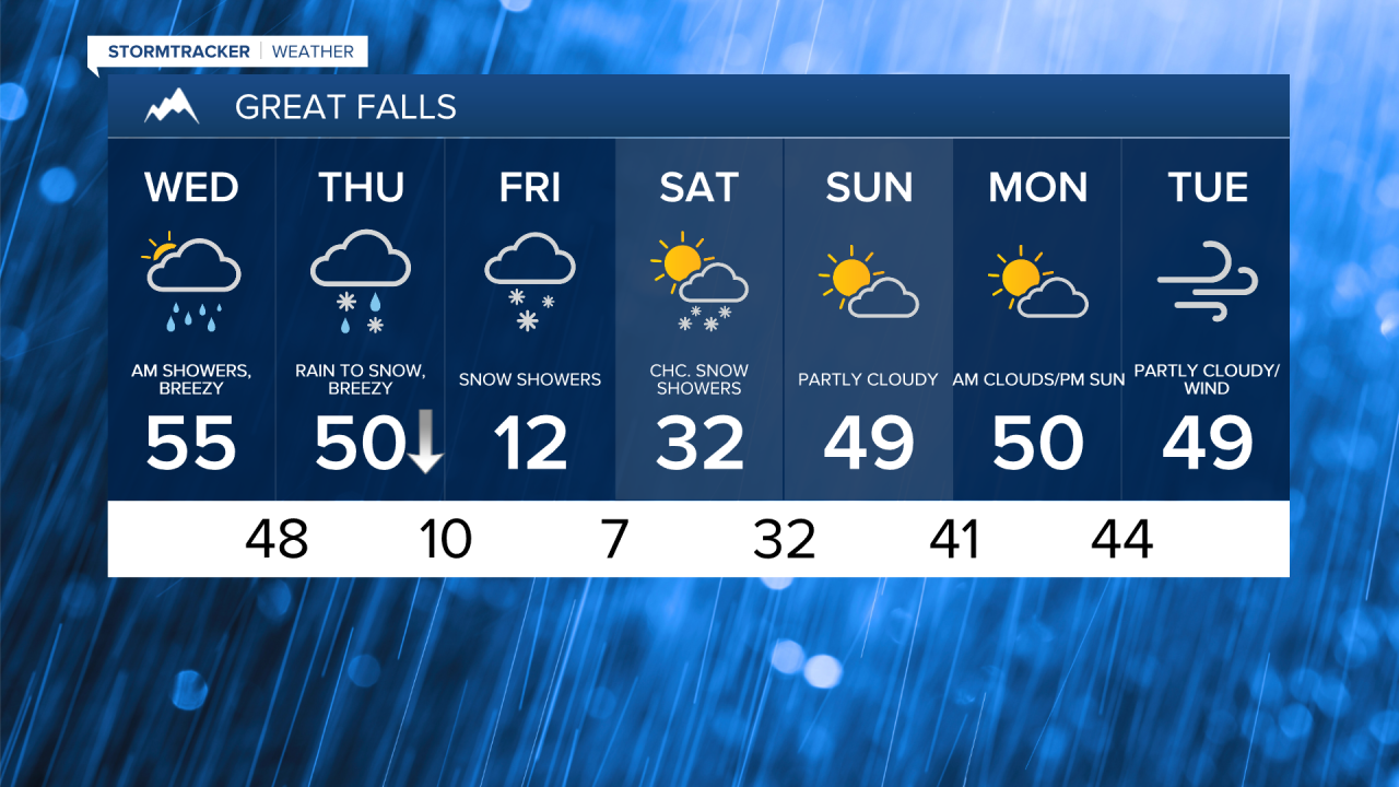
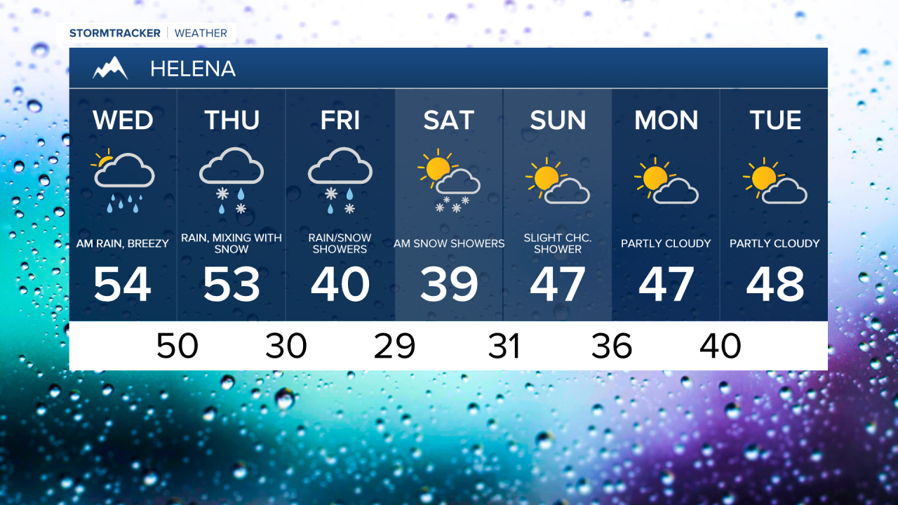
Mild and dry weather is expected for most areas as high temperatures climb into the 40s and 50s for central Montana, while northeast Montana remains colder in the 20s and 30s. The wintry mix will transition to scattered rain showers this afternoon as milder air moves in. However, some snow and freezing rain could persist in northeast Montana where temperatures remain colder Snow levels will rise to 7,000-8,000 feet as warmer air moves in.

Winds will pick up again for most of the area by Thursday morning as a cold front moves south through Montana. Morning temperatures will be in the 40s and 50s but will drop into the 10s and 20s by sunset. Rain changes to snow, with heavier bursts possible along the front. Occasional light to moderate snow will continue behind the front Thursday night into Friday.

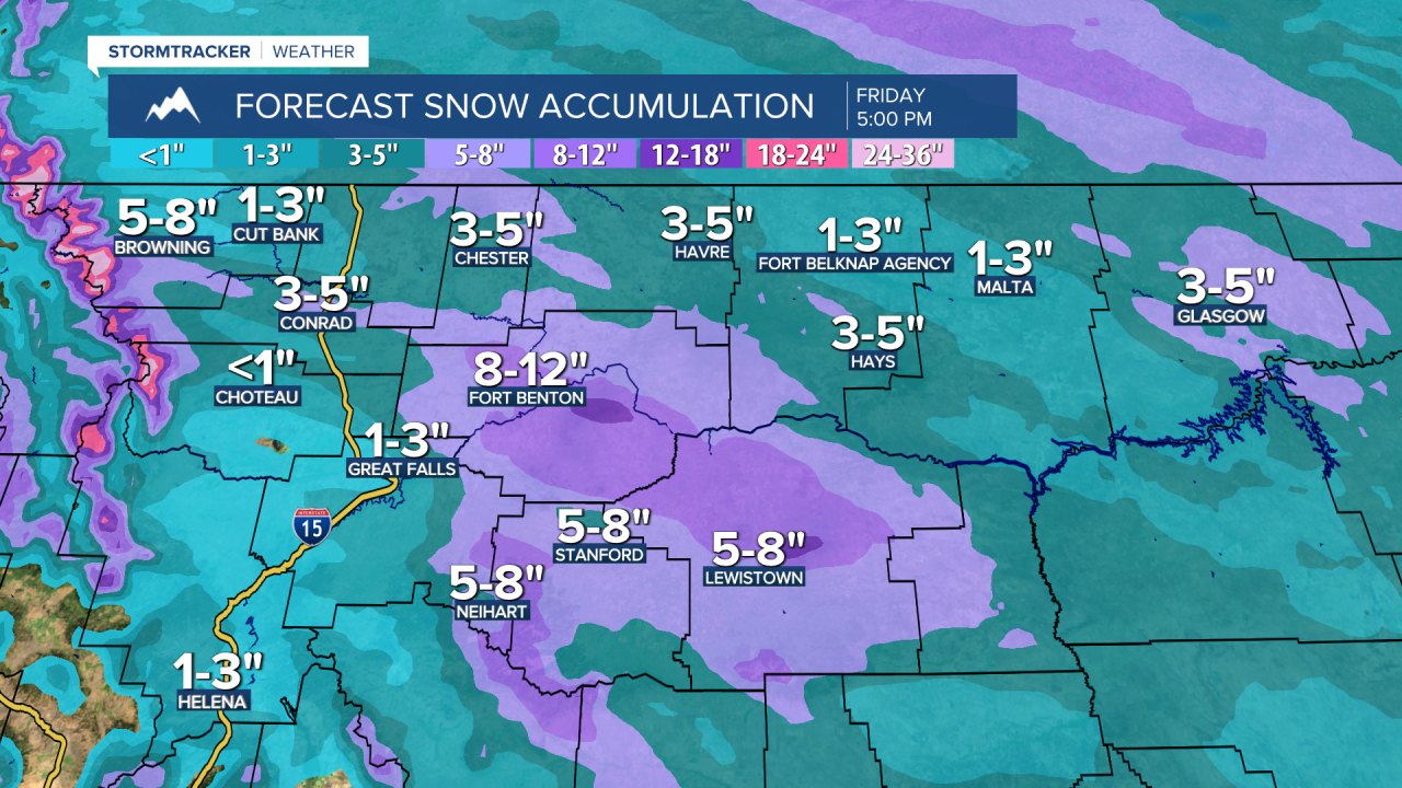
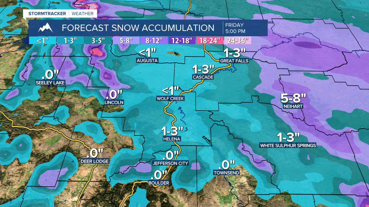
A Winter Storm Watch is in effect from Thursday afternoon through Saturday morning. A band of heavier snow is expected to develop across central Montana on Friday morning. The heaviest accumulation is likely east of Great Falls, with 2-8 inches possible in lower elevations across central and eastern Montana, and up to a foot in the mountains.
Friday will be very cold for most of the area, with highs in the 0s and 10s. However, Helena will stay milder, with temperatures in the 30s and 40s, limiting snowfall in that area. The cold air gradually retreats northward on Saturday, but temperatures on the Hi-Line will remain in the -0s and 0s, with highs in the teens and low to mid-20s south of the Hi-Line. Helena's highs will stay in the 30s and 40s. Warmer air and high winds return next week.