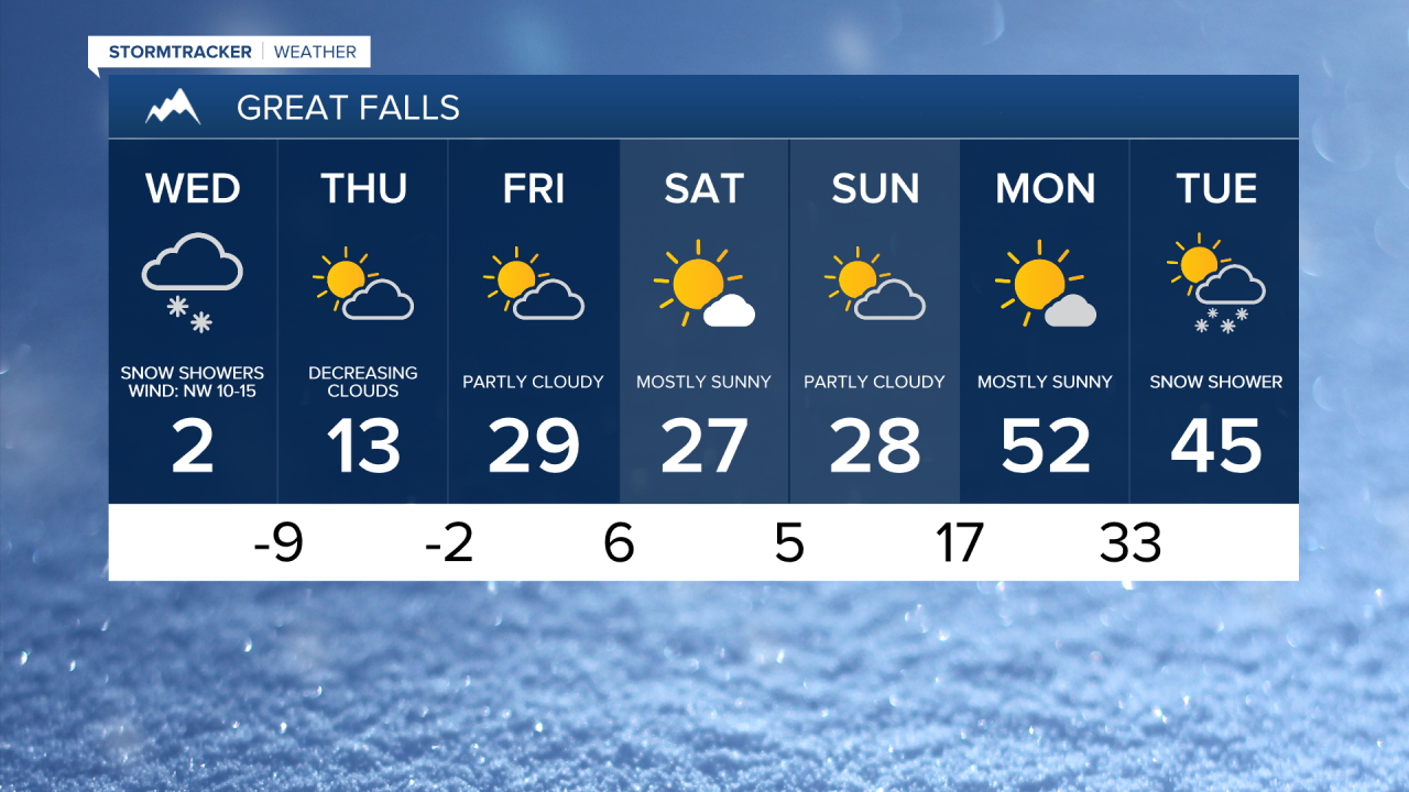
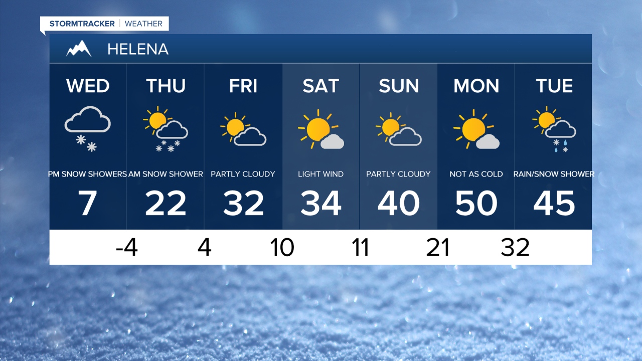
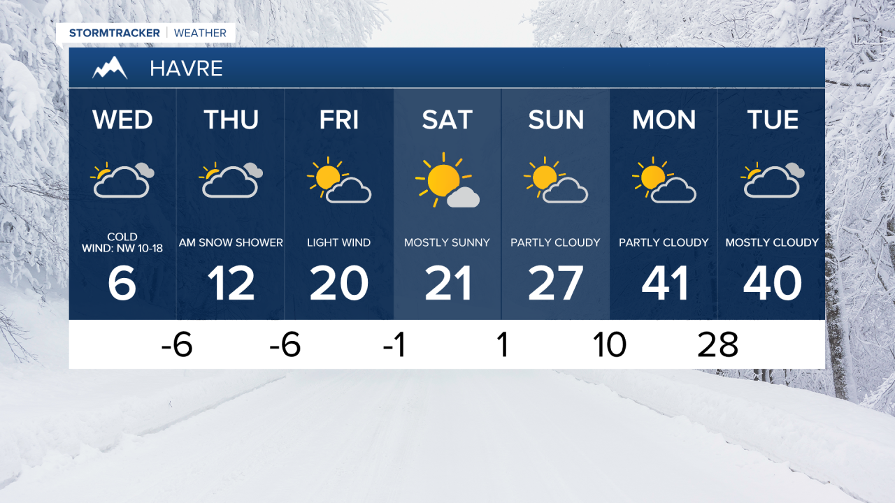
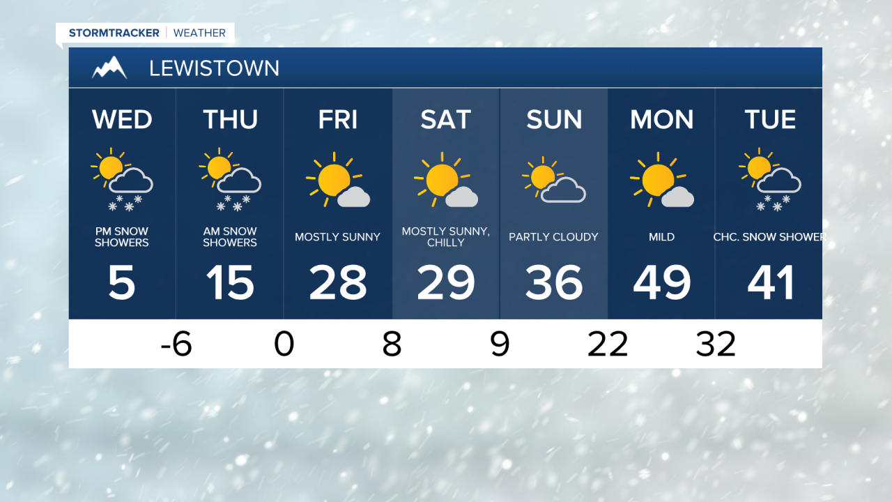
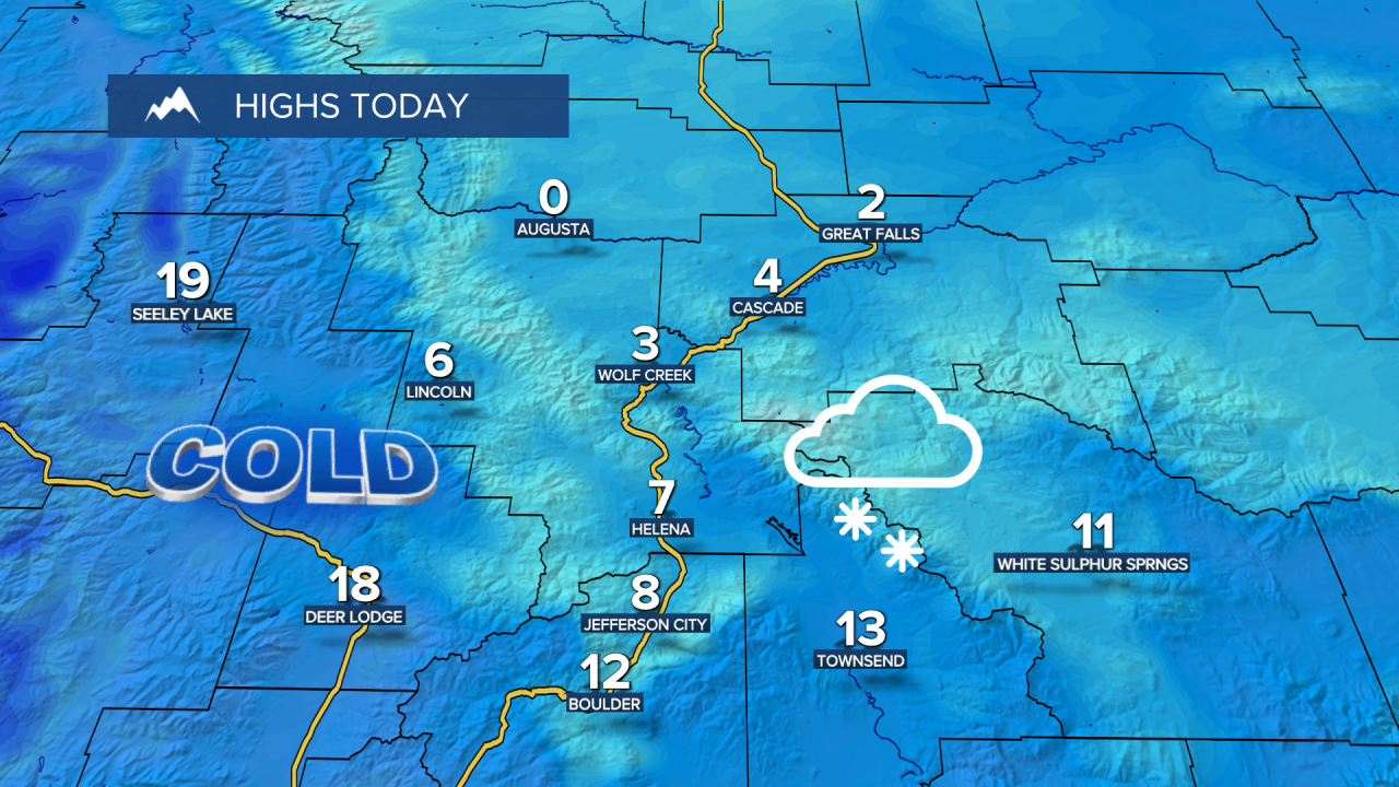
A powerful storm system brought snow, wind, and arctic air to Montana on Tuesday. Great Falls picked around 3 inches of snowfall, the most in a single day since late November. Wind chills this morning could dip as low as -40° near Cut Bank and East Glacier, with wind chills as low as -30° across central Montana. Daytime highs only reach the -0s and 0s, but the feels like temperatures won't make it above zero.
Today's Forecast:
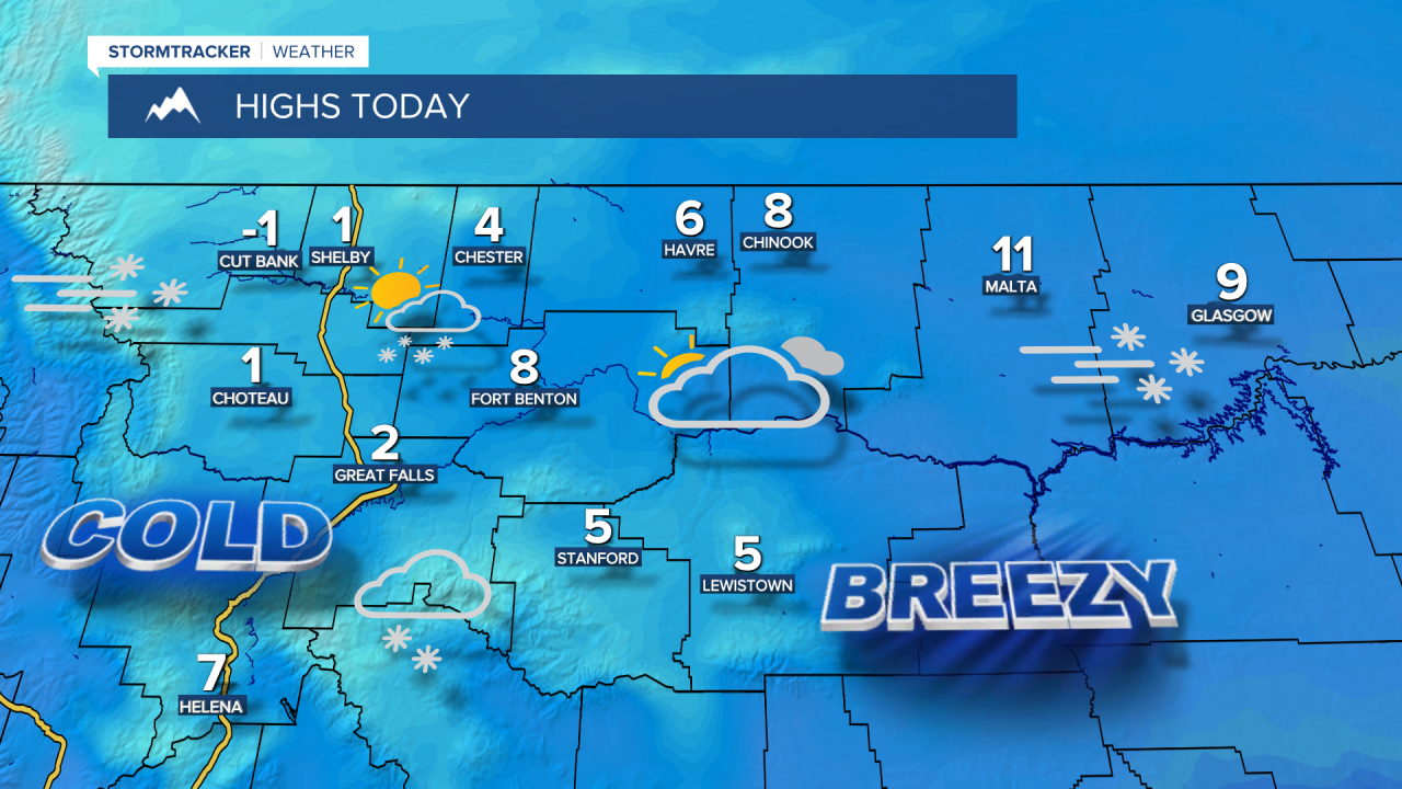

Snow showers return during the afternoon and evening as another system moves through. Light snow accumulations of a dusting to 2 inches are possible.

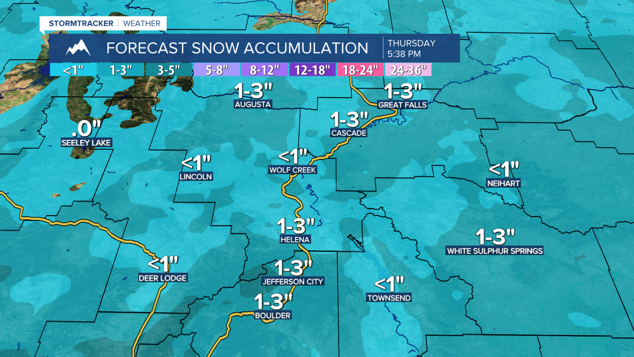
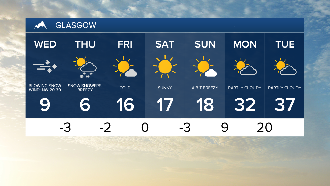
Thursday will be mostly cloudy and cold, with a few light snow showers. Highs will be in the 0s for the Hi-Line, 10s in central Montana, and 20s near Helena. High temperatures climb into the 20s and low 30s by Friday, with additional light snow showers possible.
High pressure will return bringing drier and relatively milder conditions this weekend, with mostly sunny to partly cloudy skies and high temperatures in the 20s and 30s.
A quick warmup arrives next Monday, with highs in the 40s and 50s, along with scattered rain and snow showers.