


After starting the day with widespread rain and mainly mountain snow showers, our current system will begin to exit the region tonight.
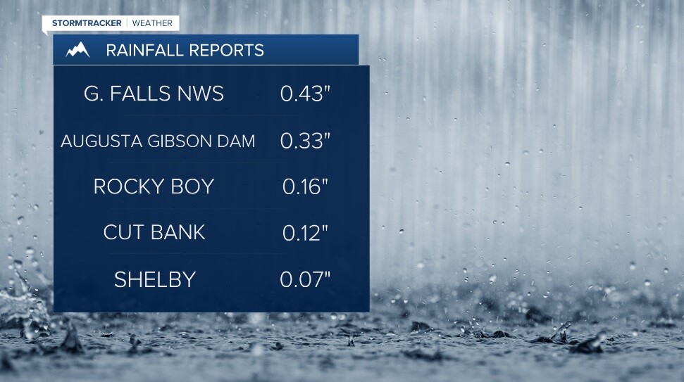
Still, that was some much needed moisture that fell across the viewing area Sunday!
Lows Monday morning will range from the mid 20s to low 30s (depending on lingering cloud cover) with patchy fog developing. The day will showcase ample sunshine with near normal highs in the upper 50s to low 60s across the region. Clouds will increase throughout Monday evening as our next system approaches.
That system will knock temps down a few degrees for Tuesday with scattered showers (perhaps a little light mountain snow and a few weak thunderstorms) with an overall mainly cloudy day.
Building high pressure should keep things dry and a little warmer for us beginning Wednesday! Look for highs in the 60s with even warmer readings in the upper 60s to mid 70s for Thursday.
Cooler and unsettled conditions look to return slowly throughout Friday and into at least the first half of the weekend.
