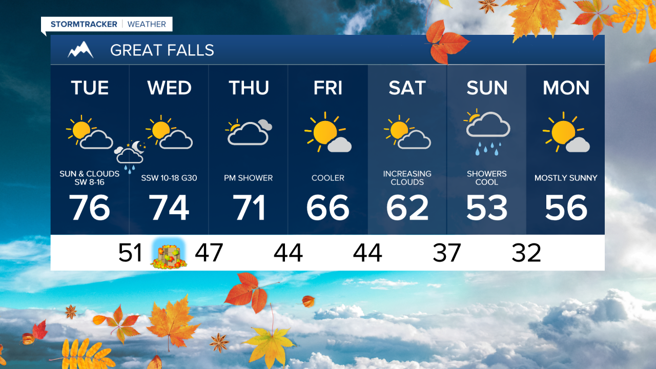
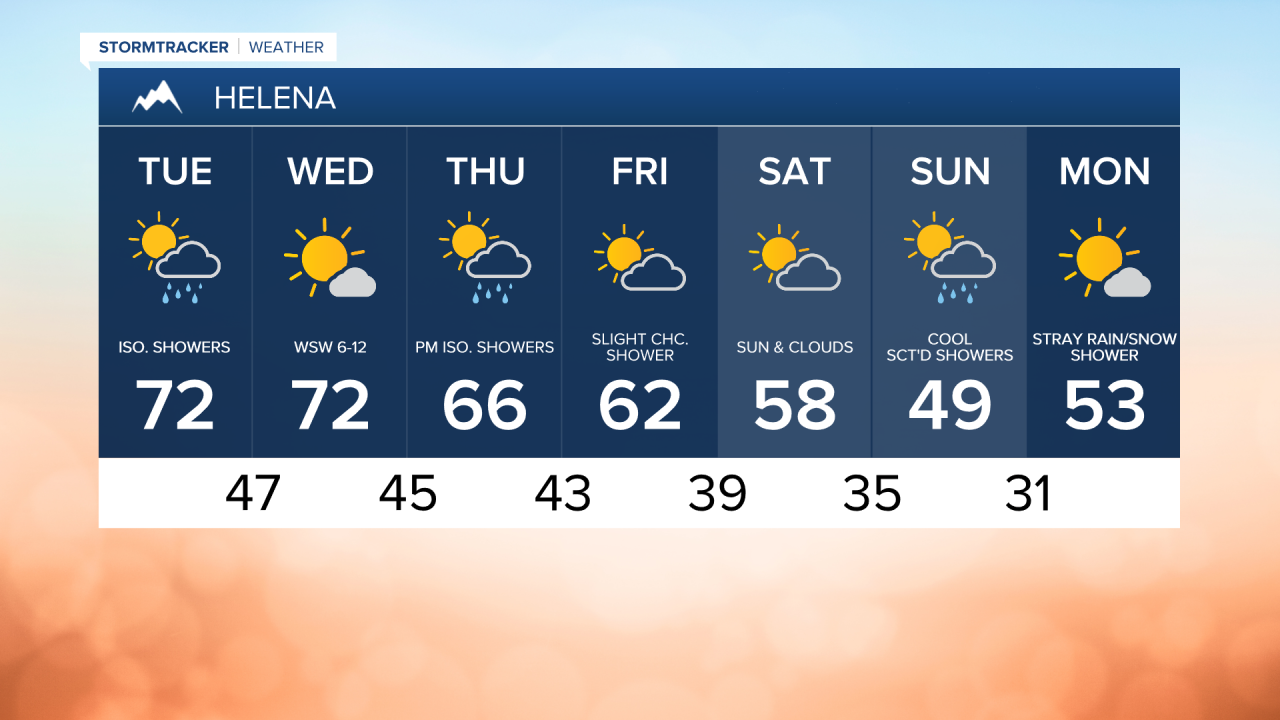
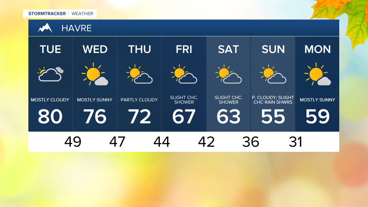
The last Monday of September was warm and summer-like, with a high temperature of 87°. A slow cooling trend is expected throughout the rest of the week. As we end September today, expect highs in the 70s in central Montana and 80s in eastern Montana. A few brief rain showers are possible as clouds increase this afternoon and evening.


Check out the forecast:
The Salmon Forks fire is burning in the Flathead National Forest east of Big Salmon Lake and has grown to 2,029 acres. This will bring some smoke and haze to the Rocky Mountain Front on Tuesday.

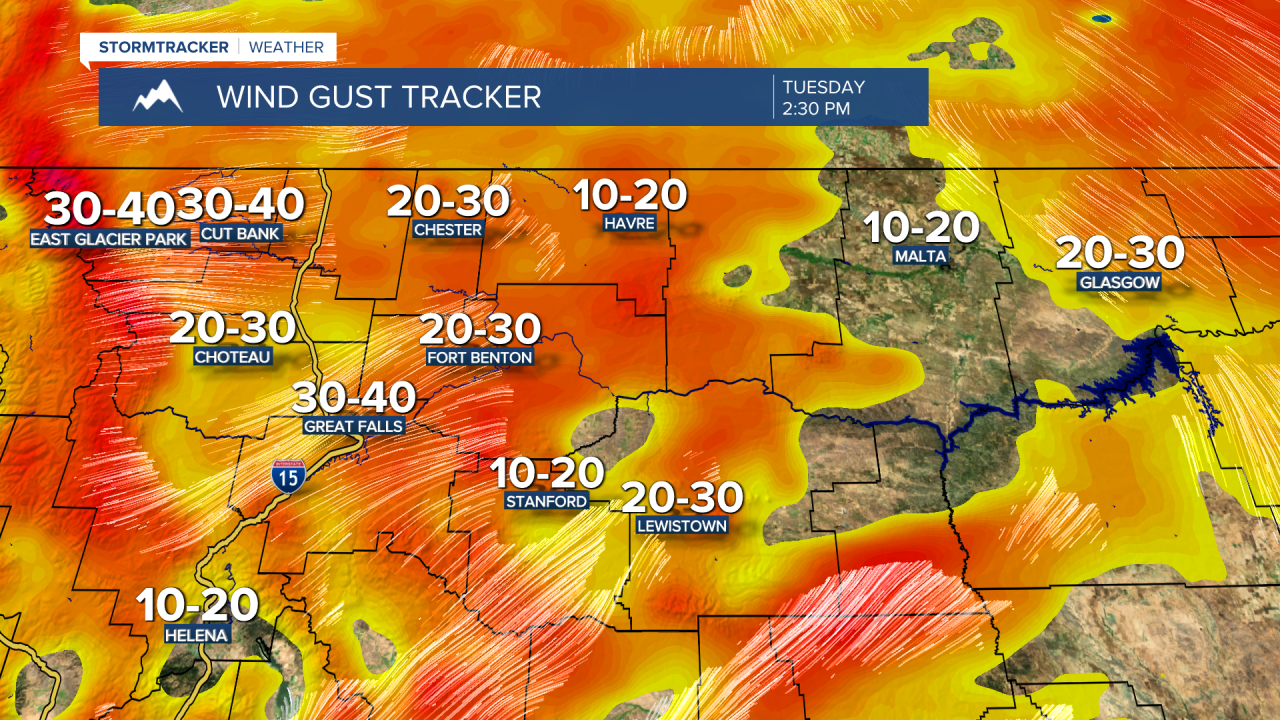
Winds will be gusty on Tuesday and Wednesday, with gusts as high as 30 mph across the area.
Daytime highs will be in the upper 60s and 70s on Wednesday and Thursday, then fall into the 60s on Friday. There will still be a chance for isolated showers, but most of each day will remain dry.
The next noticeable cold front and chance for precipitation are expected to arrive over the weekend. On Saturday, we may see some rain showers and mountain snow by evening. Scattered rain and showers will continue into the night, potentially the first accumulating snow of the season in the mountain ranges of central Montana. Some models suggest a more impactful snow, while others forecast only nuisance snow showers. We'll keep you updated!

Temperatures will cool significantly into the weekend. Daytime highs will be in the upper 50s and 60s on Saturday, then drop to the upper 40s and 50s on Sunday. The first widespread frost and freeze of the season is likely Sunday, with lows dipping into the 20s and 30s.