Congratulations, Helena! It was the snowiest October 12th on record, and more snow fell overnight. Many areas on the south and west sides of the city recorded 6 to 10 inches or more of snowfall. Here's a check on road conditions this wintry Monday morning: mountain passes are generally snow-covered, and there are areas of slush and snow on other roads and highways, especially in and around Helena. Please take it slow! Temperatures will remain cold today and tonight, so any snow that melts may refreeze.
Check out the forecast:
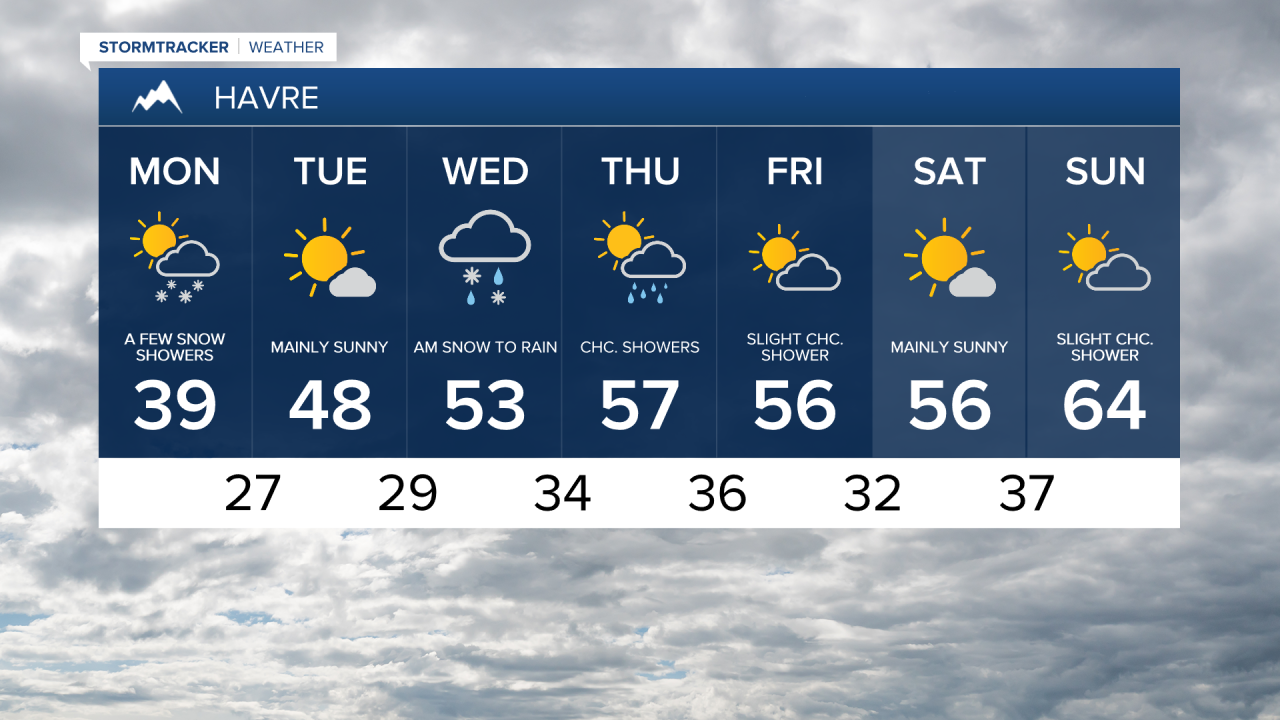
Snow should gradually diminish later this morning. Expect a cold and blustery day, with high temperatures in the upper 20s to low 30s in central Montana and in the upper 30s to lower 40s in eastern Montana.


Another round of low-elevation rain and mountain snow will move in tonight into Tuesday morning as a disturbance passes through the area. This could bring additional accumulating snow to southwest Montana, including areas south of Helena. Some areas may be slick Tuesday morning, as snowmelt from Monday could refreeze with temperatures dropping into the 20s. Temperatures are expected to rebound to the 40s on Tuesday under partly cloudy skies.

The cold air will retreat northward throughout the rest of the week. A coastal low pressure system will swing northeast toward Montana from Tuesday night through Friday, bringing additional rain and mountain snow. However, with warmer Pacific air, snow levels will be higher this time around. There may be some additional travel impacts over mountain passes.
Conditions are expected to clear this weekend, with temperatures moderating into the 50s and 60s. However, gusty winds are expected to persist throughout the weekend.