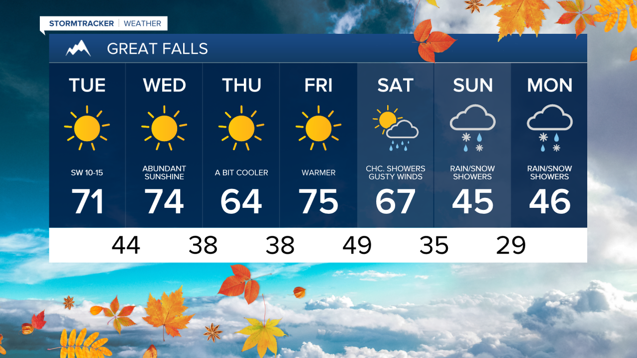
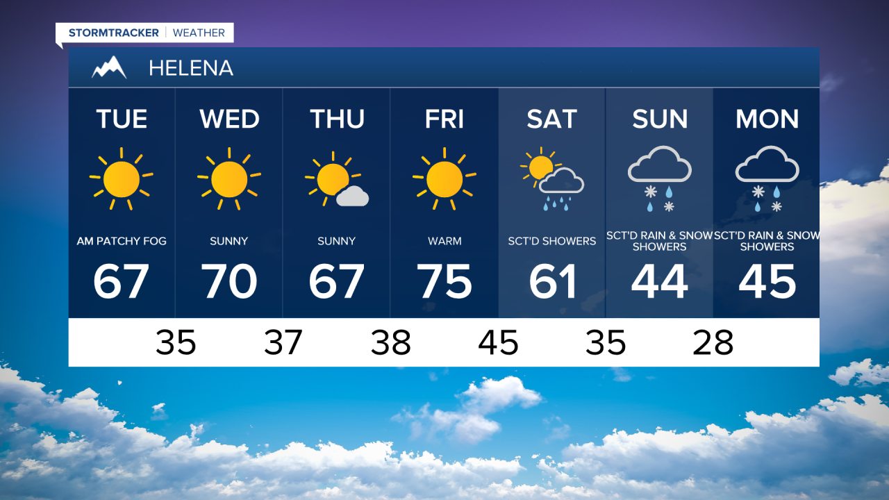
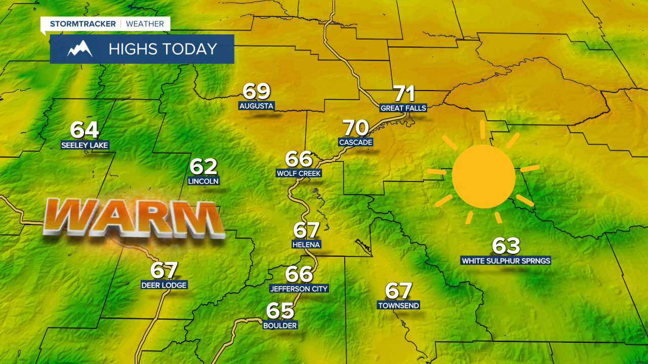
Following a cool Monday, temperatures will warm up around 10°-15° on Tuesday, with temperatures climbing into the upper 60s and lower 70s.

Check out the forecast:
High pressure continues to build into the region, with warmer and drier conditions holding steady through the rest of the week. Although, there will be a slight cooldown on Thursday as temperatures drop into the low to mid 60s. Otherwise, each day is going to be sunny and warm with highs in the upper 60s and 70s and low temperatures in the 30s and 40s.
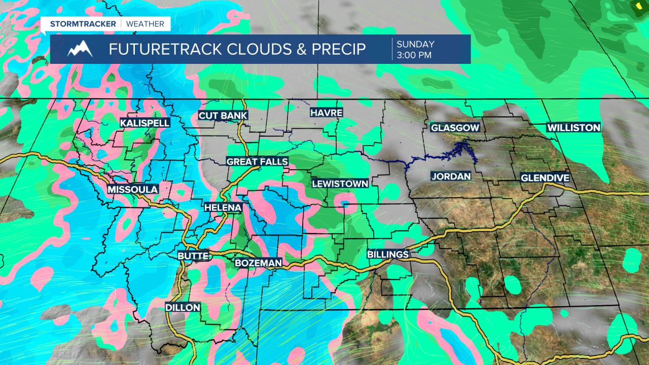
Some major changes arrive this weekend as a Pacific cold front races across Montana, bringing gusty winds, showers and thunderstorms. Snow levels will lower as a low pressure system moves in behind the front. Another round of accumulating snow is expected in the mountains and some snow may mix in for the lower elevations again Sunday into Monday.

Looking ahead to next week, temperatures will start very cool in the 40s on Monday but slowly warming through the 50s into the lower 60s throughout next week.