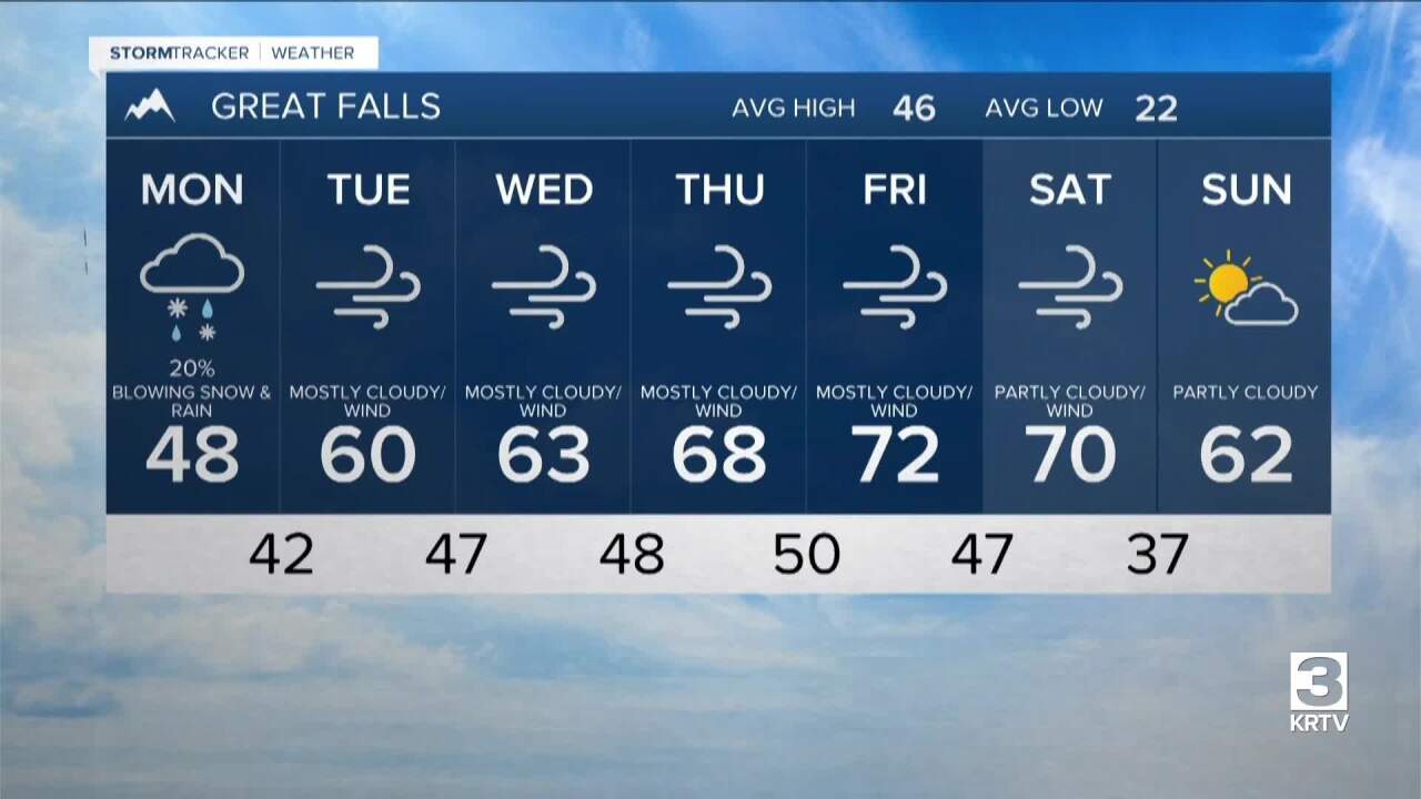

There will be some scattered rain and snow showers around late Sunday night and Monday, generally in central Montana and western portions of north-central Montana, as a warm front passes through our area.
It will be warmer on Monday as highs are going to be in the 40s in a lot of locations (30s in northeastern Montana).
The wind will also return on Monday as it is going to be windy (gusts over 60 mph are possible) along the Rocky Mountain Front and gusty (gusts over 40 mph are possible) in some areas east of the Rocky Mountain Front.
Much warmer temperatures are expected for the rest of next week as highs are going to be in the mid to upper 50s and low to mid 60s on Tuesday; the 60s on Wednesday; and the mid to upper 60s and low to mid 70s on Thursday and Friday. It is also going to be windy Tuesday through Friday as sustained wind speeds are going to be between 15 and 35 mph in a lot of locations, and wind gusts over 50 mph are possible. Along the Rocky Mountain Front, gusts over 60 mph will be possible for most of next week.
Tuesday through Friday will also be partly to mostly cloudy and mostly dry as high pressure is going to be in control of our weather. Spring will officially begin on Friday at 8:46am.
